File:Wothorpe Towers - geograph.org.uk - 1621167.jpg
From Wikishire
Size of this preview: 800 × 600 pixels. Other resolution: 320 × 240 pixels.
Original file (4,000 × 3,000 pixels, file size: 4.47 MB, MIME type: image/jpeg)
This is a photo of listed building number 1265972. |
Summary
| Description |
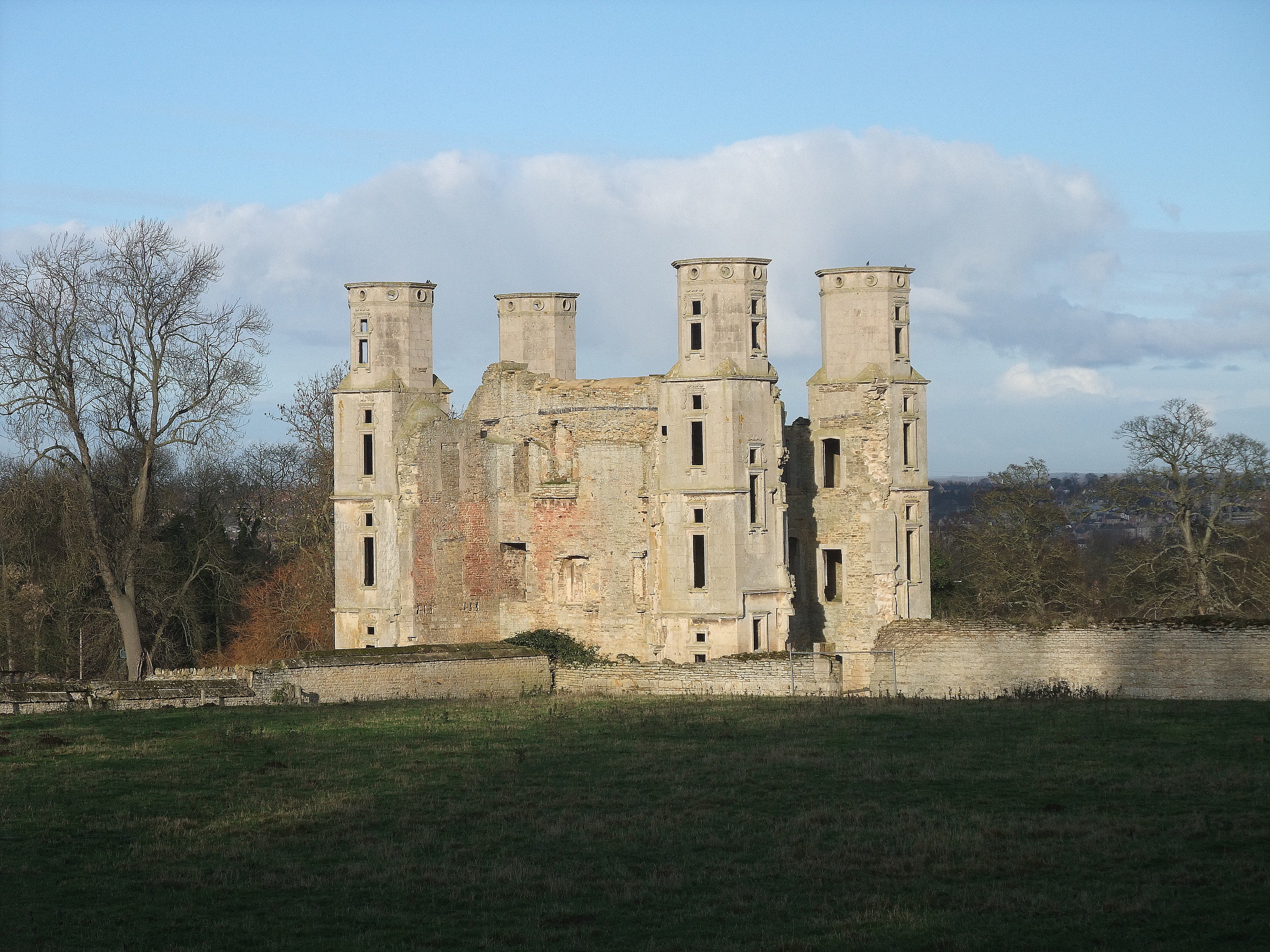
English: Wothorpe Towers, near to Easton on The Hill, Northamptonshire, Great Britain.
Grade I listed. Built by Thomas Cecil, eldest son of Lord Cecil of Burghley, in the early 17th century. Now undergoing extensive restoration <a title="http://www.wothorpe-towers.co.uk/" rel="nofollow" href="http://www.wothorpe-towers.co.uk/">Link</a><img style="padding-left:2px;" alt="External link" title="External link - shift click to open in new window" src="http://s0.geograph.org.uk/img/external.png" width="10" height="10"/> |
| Date | |
| Source | From geograph.org.uk; transferred by User:Skinsmoke using geograph_org2commons. |
| Author | Tim Heaton |
| Permission (Reusing this file) |
Creative Commons Attribution Share-alike license 2.0 |
| Attribution (required by the license) | Tim Heaton / Wothorpe Towers / |
| Camera location | | View this and other nearby images on: OpenStreetMap |
|---|
| Object location | | View this and other nearby images on: OpenStreetMap |
|---|
_region:GB-GBN_heading:0.00&language=en)
Licensing

|
This image was taken from the Geograph project collection. See this photograph's page on the Geograph website for the photographer's contact details. The copyright on this image is owned by Tim Heaton and is licensed for reuse under the Creative Commons Attribution-ShareAlike 2.0 license.
|
This file is licensed under the Creative Commons Attribution-Share Alike 2.0 Generic license.
Attribution: Tim Heaton
- You are free:
- to share – to copy, distribute and transmit the work
- to remix – to adapt the work
- Under the following conditions:
- attribution – You must give appropriate credit, provide a link to the license, and indicate if changes were made. You may do so in any reasonable manner, but not in any way that suggests the licensor endorses you or your use.
- share alike – If you remix, transform, or build upon the material, you must distribute your contributions under the same or compatible license as the original.
File history
Click on a date/time to view the file as it appeared at that time.
| Date/Time | Thumbnail | Dimensions | User | Comment | |
|---|---|---|---|---|---|
| current | 02:42, 23 July 2021 | | 4,000 × 3,000 (4.47 MB) | Geograph Update Bot | Higher-resolution version from Geograph |
File usage
The following file is a duplicate of this file (more details):
- File:Wothorpe Towers - geograph.org.uk - 1621167.jpg from a shared repository
The following page links to this file: