File:Wimbledon map.jpg
From Wikishire
Size of this preview: 514 × 599 pixels. Other resolution: 206 × 240 pixels.
Original file (2,218 × 2,585 pixels, file size: 4.6 MB, MIME type: image/jpeg)
Summary
| Description |
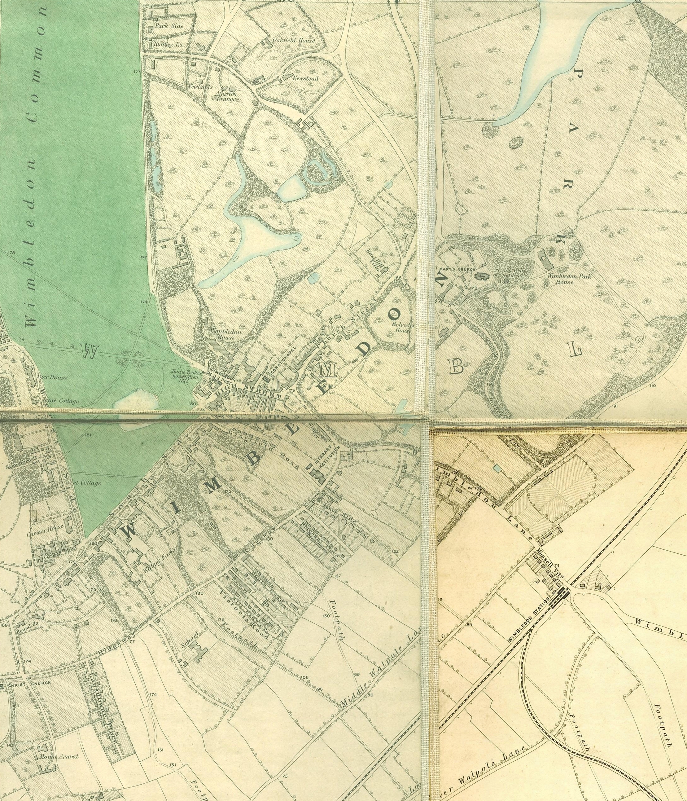
English: Wimbledon section of Edward Stanford's map of London, 1862 - 1871 |
|||||||||||||||||||
| Date | between 1862 and 1871 | |||||||||||||||||||
| Source | http://www.mappalondon.com/london/south-west/maps.htm | |||||||||||||||||||
| Author |
|
|||||||||||||||||||
Licensing
|
This work is in the public domain in its country of origin and other countries and areas where the copyright term is the author's life plus 100 years or fewer. | |
| This file has been identified as being free of known restrictions under copyright law, including all related and neighboring rights. | |
File history
Click on a date/time to view the file as it appeared at that time.
| Date/Time | Thumbnail | Dimensions | User | Comment | |
|---|---|---|---|---|---|
| current | 18:42, 14 January 2011 | | 2,218 × 2,585 (4.6 MB) | SilkTork | {{Information |Description={{en|1=Wimbledon section of Edward Stanford's map of London, 1862 - 1871 }} |Source=http://www.mappalondon.com/london/south-west/maps.htm |Author=Edward Stanford (died 1904) |Date=18 |
File usage
The following file is a duplicate of this file (more details):
- File:Wimbledon map.jpg from a shared repository
The following page links to this file: