File:Wfm jura landsat.jpg
From Wikishire

Size of this preview: 800 × 593 pixels. Other resolution: 320 × 237 pixels.
Original file (1,280 × 948 pixels, file size: 328 KB, MIME type: image/jpeg)
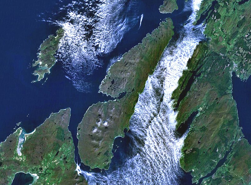
The island of Jura off the west coast of Scotland. The large island to the southwest is Islay, and north of it is Colonsay. To the east is the Kintyre peninsula. The small round island just to the north is Scarba.
This is Landsat7 imagery, collected using NASA World Wind.
| This image is in the public domain because it is a screenshot from NASA’s globe software World Wind using a public domain layer, such as Blue Marble, MODIS, Landsat, SRTM, USGS or GLOBE.
|
 |
File history
Click on a date/time to view the file as it appeared at that time.
| Date/Time | Thumbnail | Dimensions | User | Comment | |
|---|---|---|---|---|---|
| current | 19:48, 4 August 2005 | | 1,280 × 948 (328 KB) | Finlay McWalter | The island of Jura off the west coast of Scotland. This is Landsat7 imagery, collected using NASA World Wind. {{PD-USGov-NASA}} category:islands category:scotland category:satellite photos |
File usage
The following file is a duplicate of this file (more details):
- File:Wfm jura landsat.jpg from a shared repository
The following page links to this file: