File:Westgate Gardens 5.JPG
From Wikishire

Size of this preview: 800 × 600 pixels. Other resolution: 320 × 240 pixels.
Original file (1,024 × 768 pixels, file size: 221 KB, MIME type: image/jpeg)
Summary
| Description |
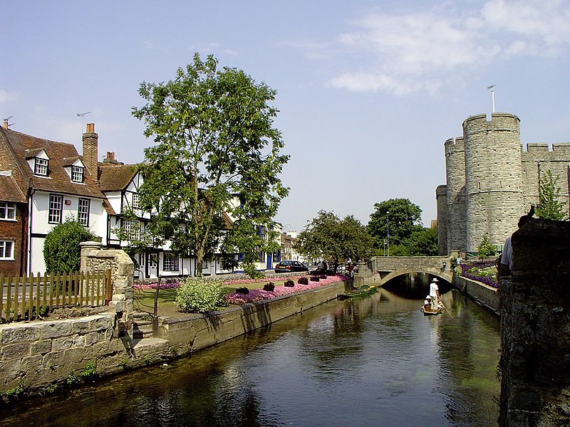
English: The River Stour runs through Westgate Gardens, Canterbury. The river skirts the route of the old city walls, and the stone towers of the city's west gate (still used by traffic) can be seen on the right.
Русский: Река "Великий Стаур" течёт сквозь "Westgate Gardens", в центре города.
|
||||
| Date | |||||
| Source |
michaelpead.co.uk |
||||
| Author | Michael Pead | ||||
| Permission (Reusing this file) |
The author gives permission to use this file under the Attribution-ShareAlike 2.0 UK: England & Wales license. |
Licensing
This file is licensed under the Creative Commons Attribution-Share Alike 2.0 UK: England & Wales license.
- You are free:
- to share – to copy, distribute and transmit the work
- to remix – to adapt the work
- Under the following conditions:
- attribution – You must give appropriate credit, provide a link to the license, and indicate if changes were made. You may do so in any reasonable manner, but not in any way that suggests the licensor endorses you or your use.
- share alike – If you remix, transform, or build upon the material, you must distribute your contributions under the same or compatible license as the original.


|
Attribution information, such as the author's name, e-mail, website, or signature, that was once visible in the image itself has been moved into the image metadata and/or image description page. This makes the image easier to reuse and more language-neutral, and makes the text easier to process and search for. Commons discourages placing visible author information in images.
|
File history
Click on a date/time to view the file as it appeared at that time.
| Date/Time | Thumbnail | Dimensions | User | Comment | |
|---|---|---|---|---|---|
| current | 00:53, 7 June 2011 | | 1,024 × 768 (221 KB) | Quibik | Removed the watermark. |
File usage
The following file is a duplicate of this file (more details):
- File:Westgate Gardens 5.JPG from a shared repository
The following page links to this file: