File:Watery Lane Junction.jpg
From Wikishire

Size of this preview: 800 × 600 pixels. Other resolution: 320 × 240 pixels.
Original file (3,648 × 2,736 pixels, file size: 3.52 MB, MIME type: image/jpeg)
Summary
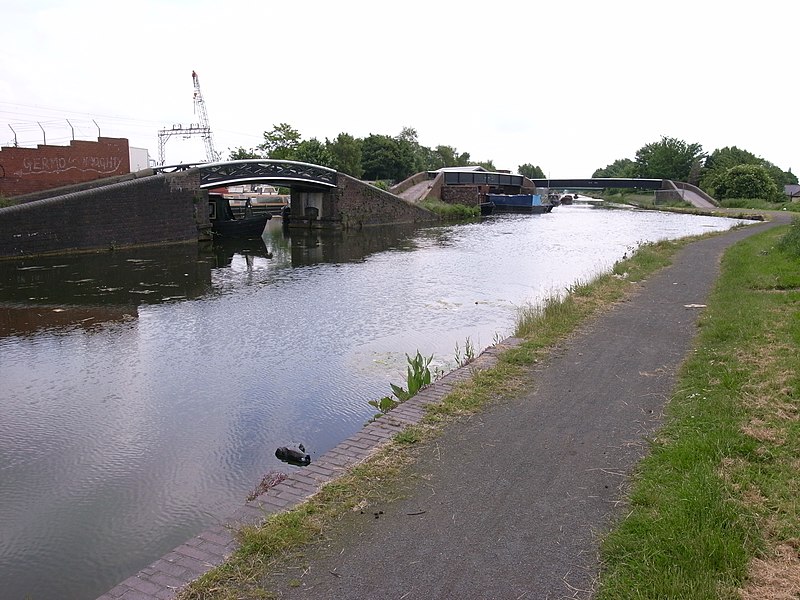
| Description | Watery Lane Junction on the BCN New Main Line Canal in Tipton, West Midlands, England. Flowing from the left through the right-hand bridge is the BCN New Main Line. The left and centre bridge lead to an old wharf, now Caggy's Boatyard (on this site since 1960s), which was also the start of the Toll End Communication Canal (built 1809, closed 1966 and later filled in). The widening of the water to the right was the entrance to the defunct Tipton Green Canal, built 1805, closed 1966 and later filled in, now a public walkway. | ||
| Date | |||
| Source | Self made photo by Oosoom | ||
| Author | Oosoom | ||
| Permission (Reusing this file) |
I, the copyright holder of this work, hereby publish it under the following licenses:
This file is licensed under the Creative Commons Attribution-Share Alike 3.0 Unported license.
You may select the license of your choice. |

| Camera location | | View this and other nearby images on: OpenStreetMap |
|---|
File history
Click on a date/time to view the file as it appeared at that time.
| Date/Time | Thumbnail | Dimensions | User | Comment | |
|---|---|---|---|---|---|
| current | 14:22, 7 June 2008 | | 3,648 × 2,736 (3.52 MB) | Oosoom | {{Information |Description=Watery Lane Junction on the BCN New main Line Canal in Tipton, West Midlands (county), England. Flowing from left through right-hand bridge is the BCN New M |
File usage
The following file is a duplicate of this file (more details):
- File:Watery Lane Junction.jpg from a shared repository
The following page links to this file: