File:VCH counties.svg
From Wikishire

Size of this preview: 469 × 599 pixels. Other resolution: 188 × 240 pixels.
Original file (SVG file, nominally 808 × 1,032 pixels, file size: 1,004 KB)
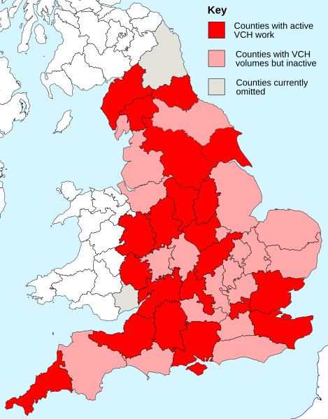
| Description | Map of the counties covered by the Victoria County History | ||
| Date | |||
| Source |
|
||
| Author | Visitor from Wikishire | ||
| Permission (Reusing this file) |
|
File history
Click on a date/time to view the file as it appeared at that time.
| Date/Time | Thumbnail | Dimensions | User | Comment | |
|---|---|---|---|---|---|
| current | 22:37, 29 May 2015 | | 808 × 1,032 (1,004 KB) | Visitor from Wikishire | {{Information |Description=Map of the counties covered by the Victoria County History |Source=*British Isles in counties.svg *{{own}} |Date=2015-05-29 |Author=[[User:Visitor from Wikishire|Visitor from Wikishire]... |
File usage
The following file is a duplicate of this file (more details):
- File:VCH counties.svg from a shared repository
The following page links to this file: