File:Toll Road through Ashridge - geograph.org.uk - 243214.jpg
From Wikishire

Size of this preview: 450 × 600 pixels. Other resolution: 180 × 240 pixels.
Original file (480 × 640 pixels, file size: 140 KB, MIME type: image/jpeg)
Summary
| Description |
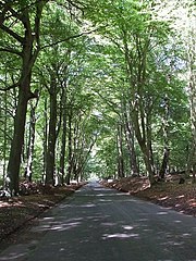
English: Toll Road through Ashridge. This lane through Ashridge Park which passes 83838 is a toll road, but usually there is no-one there to request the 50p - but even if there is it is well worth the money as this is a particularly attractive drive and there are usually deer wandering around in the woods or even sauntering across the road.
It is advisable to drive nice and slowly, mainly to protect the wildlife, but also because there are some particularly aggressive speed bumps ! |
| Date | |
| Source | From geograph.org.uk |
| Author | Rob Farrow |
| Attribution (required by the license) | Rob Farrow / Toll Road through Ashridge / |
| Object location | | View this and other nearby images on: OpenStreetMap |
|---|
_heading:315.00&language=en)
Licensing

|
This image was taken from the Geograph project collection. See this photograph's page on the Geograph website for the photographer's contact details. The copyright on this image is owned by Rob Farrow and is licensed for reuse under the Creative Commons Attribution-ShareAlike 2.0 license.
|
This file is licensed under the Creative Commons Attribution-Share Alike 2.0 Generic license.
Attribution: Rob Farrow
- You are free:
- to share – to copy, distribute and transmit the work
- to remix – to adapt the work
- Under the following conditions:
- attribution – You must give appropriate credit, provide a link to the license, and indicate if changes were made. You may do so in any reasonable manner, but not in any way that suggests the licensor endorses you or your use.
- share alike – If you remix, transform, or build upon the material, you must distribute your contributions under the same or compatible license as the original.
- Remove redundant categories and try to put this image in the most specific category/categories
- Remove this template
- The location categories are based on information from this geonames tool and this OpenStreetMap tool combined with a database. You can also have a look at this tool from mysociety.
- The topic category from Geograph was Woodland (find similar images at Geograph)
File history
Click on a date/time to view the file as it appeared at that time.
| Date/Time | Thumbnail | Dimensions | User | Comment | |
|---|---|---|---|---|---|
| current | 16:42, 1 February 2010 | | 480 × 640 (140 KB) | GeographBot | == {{int:filedesc}} == {{Information |description={{en|1=Toll Road through Ashridge. This lane through Ashridge Park which passes [[[83838]]] is a toll road, but usually there is no-one there to request the 50p - but even if there is it is well worth the |
File usage
The following file is a duplicate of this file (more details):
- File:Toll Road through Ashridge - geograph.org.uk - 243214.jpg from a shared repository
The following page links to this file: