File:TilburyThames8798.JPG
From Wikishire

Size of this preview: 800 × 600 pixels. Other resolution: 320 × 240 pixels.
Original file (2,048 × 1,536 pixels, file size: 756 KB, MIME type: image/jpeg)
| Description |
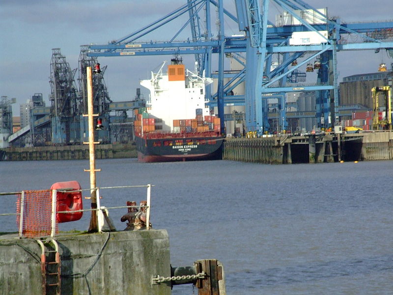
Northfleet merges with Gravesend in Kent. It is on the River Thames estuary. The shore has been excated for chalk, and heavy industry used the recovered land.. Northfleet Hope flows NW-SE, and as it rounds Tilbury Ness, into Gravesend Reach, the flow changes W-E. The container ship Saigon Express, registered in Hong Kong is berthed in Tilbury
|
||||
| Date | Published 12/2008 | ||||
| Source | Own work | ||||
| Author | Clem Rutter, Rochester, Kent. | ||||
| Permission (Reusing this file) |
Own work, attribution required (Multi-license with GFDL and Creative Commons CC-BY 2.5) |
I, the copyright holder of this work, hereby publish it under the following licenses:

|
Permission is granted to copy, distribute and/or modify this document under the terms of the GNU Free Documentation License, Version 1.2 or any later version published by the Free Software Foundation; with no Invariant Sections, no Front-Cover Texts, and no Back-Cover Texts. A copy of the license is included in the section entitled GNU Free Documentation License. |
| This file is licensed under the Creative Commons Attribution-Share Alike 3.0 Unported license. | ||
| ||
| This licensing tag was added to this file as part of the GFDL licensing update. |
This file is licensed under the Creative Commons Attribution 2.5 Generic license.
- You are free:
- to share – to copy, distribute and transmit the work
- to remix – to adapt the work
- Under the following conditions:
- attribution – You must give appropriate credit, provide a link to the license, and indicate if changes were made. You may do so in any reasonable manner, but not in any way that suggests the licensor endorses you or your use.
You may select the license of your choice.
File history
Click on a date/time to view the file as it appeared at that time.
| Date/Time | Thumbnail | Dimensions | User | Comment | |
|---|---|---|---|---|---|
| current | 19:59, 21 December 2008 | | 2,048 × 1,536 (756 KB) | ClemRutter | {{Information |Description={{w|Northfleet}} merges with {{w|Gravesend}} in Kent. It is on the River Thames estuary. The shore has been excated for chalk, and heavy industry used the recovered land.. Northfleet Hope flows NW-SE, and as it rounds Tilbury N |
File usage
The following file is a duplicate of this file (more details):
- File:TilburyThames8798.JPG from a shared repository
The following page links to this file: