File:Summit of Ben MacDui - geograph.org.uk - 50972.jpg
From Wikishire
No higher resolution available.
Summit_of_Ben_MacDui_-_geograph.org.uk_-_50972.jpg (640 × 480 pixels, file size: 46 KB, MIME type: image/jpeg)
Summary
| Description |
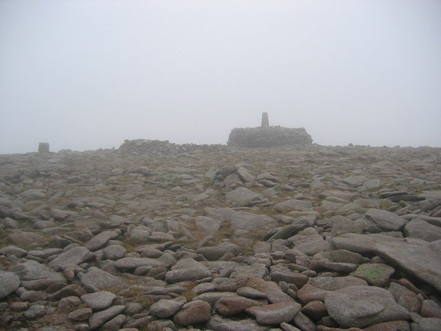
English: Summit of Ben MacDui. Scotland's runner up in height. The summit cairn and trig pillar in usual mist at 1309m. Often inaccessible due to evil weather, it was relatively benign on this day. A popular tourist hill, the summit smells almost as bad as the top of Ben Nevis. It could be worse, one of the landowners planned to build a 30m+ high pyramid up here as a mausoleum, and to out top that 1344m upstart in Lochaber.
Last time I was here I could see from Caithness to the Cheviot, not so today. This is the hill version of Loch Ness, reputed haunted by a variety of apparitions the favourite being a 5m spectre who takes one step for every 3 you take. |
| Date | |
| Source | From geograph.org.uk |
| Author | Richard Webb |
| Attribution (required by the license) | Richard Webb / Summit of Ben MacDui / |
| Object location | | View this and other nearby images on: OpenStreetMap |
|---|
_&language=en)
Licensing

|
This image was taken from the Geograph project collection. See this photograph's page on the Geograph website for the photographer's contact details. The copyright on this image is owned by Richard Webb and is licensed for reuse under the Creative Commons Attribution-ShareAlike 2.0 license.
|
This file is licensed under the Creative Commons Attribution-Share Alike 2.0 Generic license.
Attribution: Richard Webb
- You are free:
- to share – to copy, distribute and transmit the work
- to remix – to adapt the work
- Under the following conditions:
- attribution – You must give appropriate credit, provide a link to the license, and indicate if changes were made. You may do so in any reasonable manner, but not in any way that suggests the licensor endorses you or your use.
- share alike – If you remix, transform, or build upon the material, you must distribute your contributions under the same or compatible license as the original.
File history
Click on a date/time to view the file as it appeared at that time.
| Date/Time | Thumbnail | Dimensions | User | Comment | |
|---|---|---|---|---|---|
| current | 19:37, 30 January 2010 | | 640 × 480 (46 KB) | GeographBot | == {{int:filedesc}} == {{Information |description={{en|1=Summit of Ben MacDui. Scotland's runner up in height. The summit cairn and trig pillar in usual mist at 1309m. Often inaccessible due to evil weather, it was relatively benign on this day. A popular |
File usage
The following file is a duplicate of this file (more details):
- File:Summit of Ben MacDui - geograph.org.uk - 50972.jpg from a shared repository
The following page links to this file: