File:St Mark, Amcotts - geograph.org.uk - 423061.jpg
From Wikishire
No higher resolution available.
St_Mark,_Amcotts_-_geograph.org.uk_-_423061.jpg (640 × 480 pixels, file size: 70 KB, MIME type: image/jpeg)
Summary
| Description |
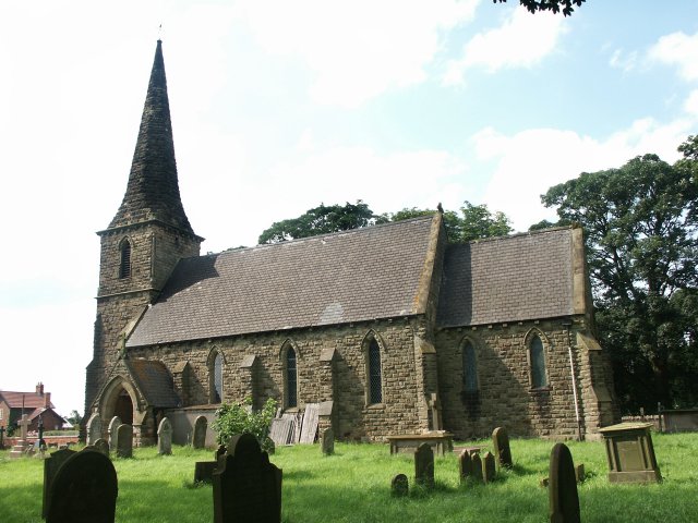
English: St Mark, Amcotts Standing near Flixborough and by the River Trent, the church of St Mark was built in the 1850s. The present building is the third to be built on the site. The foundation stone was laid on Tuesday 22nd October 1850 and was completed and dedicated to St Mark a year later, although the exact date is unknown. On 1st June 1974 the church was badly damaged with the Nypro explosion at Flixborough when the blast lifted the roof and dropped it again leaving a gap of 8 inches at the apex. The stained glass east window was completely blown in, there were cracks in the outer walls and it looked as though the church may have to be pulled down. Restoration did take place and although it also meant remaking the east window, the work was completed in two years. |
| Date | |
| Source | From geograph.org.uk |
| Author | Dave Hitchborne |
| Attribution (required by the license) | Dave Hitchborne / St Mark, Amcotts / |
| Camera location | | View this and other nearby images on: OpenStreetMap |
|---|
_heading:315.00&language=en)
| Object location | | View this and other nearby images on: OpenStreetMap |
|---|
_heading:315.00&language=en)
Licensing

|
This image was taken from the Geograph project collection. See this photograph's page on the Geograph website for the photographer's contact details. The copyright on this image is owned by Dave Hitchborne and is licensed for reuse under the Creative Commons Attribution-ShareAlike 2.0 license.
|
This file is licensed under the Creative Commons Attribution-Share Alike 2.0 Generic license.
Attribution: Dave Hitchborne
- You are free:
- to share – to copy, distribute and transmit the work
- to remix – to adapt the work
- Under the following conditions:
- attribution – You must give appropriate credit, provide a link to the license, and indicate if changes were made. You may do so in any reasonable manner, but not in any way that suggests the licensor endorses you or your use.
- share alike – If you remix, transform, or build upon the material, you must distribute your contributions under the same or compatible license as the original.
File history
Click on a date/time to view the file as it appeared at that time.
| Date/Time | Thumbnail | Dimensions | User | Comment | |
|---|---|---|---|---|---|
| current | 05:35, 4 February 2011 | | 640 × 480 (70 KB) | GeographBot | == {{int:filedesc}} == {{Information |description={{en|1=St Mark, Amcotts Standing near Flixborough and by the River Trent, the church of St Mark was built in the 1850s. The present building is the third to be built on the site. The foundation stone was |
File usage
The following file is a duplicate of this file (more details):
- File:St Mark, Amcotts - geograph.org.uk - 423061.jpg from a shared repository
The following page links to this file: