File:St Fagans Castle - geograph.org.uk - 524416.jpg
From Wikishire
No higher resolution available.
St_Fagans_Castle_-_geograph.org.uk_-_524416.jpg (640 × 480 pixels, file size: 79 KB, MIME type: image/jpeg)
Summary
| Description |
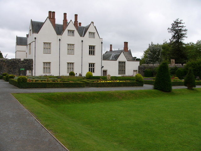
English: St Fagans Castle Peter le Sore raised a ringwork here after dispossessing the Welsh lord Meurig ap Hywell in 1091. In the early C14 the castle passed to the le Vele family by marriage, and in 1475 it passed to David Mathew when he married Alice le Vele. The descendants of their daughters sold the castle to Dr John Gibbon in c1560, who built this fine mansion in the court. |
| Date | |
| Source | https://www.geograph.org.uk/photo/524416 |
| Author | Chris Gunns |
| Attribution (required by the license) | Chris Gunns / St Fagans Castle / |
| Camera location | | View this and other nearby images on: OpenStreetMap |
|---|
_heading:180.00&language=en)
| Object location | | View this and other nearby images on: OpenStreetMap |
|---|
_heading:180.00&language=en)
Licensing

|
This image was taken from the Geograph project collection. See this photograph's page on the Geograph website for the photographer's contact details. The copyright on this image is owned by Chris Gunns and is licensed for reuse under the Creative Commons Attribution-ShareAlike 2.0 license.
|
This file is licensed under the Creative Commons Attribution-Share Alike 2.0 Generic license.
Attribution: Chris Gunns
- You are free:
- to share – to copy, distribute and transmit the work
- to remix – to adapt the work
- Under the following conditions:
- attribution – You must give appropriate credit, provide a link to the license, and indicate if changes were made. You may do so in any reasonable manner, but not in any way that suggests the licensor endorses you or your use.
- share alike – If you remix, transform, or build upon the material, you must distribute your contributions under the same or compatible license as the original.
File history
Click on a date/time to view the file as it appeared at that time.
| Date/Time | Thumbnail | Dimensions | User | Comment | |
|---|---|---|---|---|---|
| current | 17:31, 5 February 2011 | | 640 × 480 (79 KB) | GeographBot | == {{int:filedesc}} == {{Information |description={{en|1=St Fagans Castle Peter le Sore raised a ringwork here after dispossessing the Welsh lord Meurig ap Hywell in 1091. In the early C14 the castle passed to the le Vele family by marriage, and in 1475 i |
File usage
The following file is a duplicate of this file (more details):
- File:St Fagans Castle - geograph.org.uk - 524416.jpg from a shared repository
The following 2 pages link to this file: