File:St. Michael's, Burwell, Lincs - geograph.org.uk - 52305.jpg
From Wikishire

Size of this preview: 449 × 600 pixels. Other resolution: 179 × 240 pixels.
Original file (479 × 640 pixels, file size: 142 KB, MIME type: image/jpeg)
Summary
| Description |
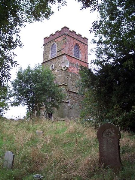
English: St. Michael's; Burwell, Lincs. In the Norman era, there was a priory of Benedictine monks here, founded by John de HAY. It was affiliated with the abbey at Bordeaux.
The Anglican parish church is dedicated to St Michael, and is an ancient building of apparent Norman origin. The church was restored in 1911. Anglican parish registers exist from 1586. As of late 2004, the registers have not been deposited in the Lincs. Archives, nor have they been filmed by the LDS Family History Library. And copies of the Bishop's Transcripts have not been deposited either. Burwell is a village and a parish in the Wold Hills of Lincolnshire, situated on the Spilsby road 5 miles southeast of Louth, and 3 miles west of Authorpe. The parish covers just over 2,000 acres. |
| Date | |
| Source | From geograph.org.uk |
| Author | Andrew Telfer |
| Attribution (required by the license) | Andrew Telfer / St. Michael's; Burwell, Lincs / |
| Object location | | View this and other nearby images on: OpenStreetMap |
|---|
_&language=en)
Licensing

|
This image was taken from the Geograph project collection. See this photograph's page on the Geograph website for the photographer's contact details. The copyright on this image is owned by Andrew Telfer and is licensed for reuse under the Creative Commons Attribution-ShareAlike 2.0 license.
|
This file is licensed under the Creative Commons Attribution-Share Alike 2.0 Generic license.
Attribution: Andrew Telfer
- You are free:
- to share – to copy, distribute and transmit the work
- to remix – to adapt the work
- Under the following conditions:
- attribution – You must give appropriate credit, provide a link to the license, and indicate if changes were made. You may do so in any reasonable manner, but not in any way that suggests the licensor endorses you or your use.
- share alike – If you remix, transform, or build upon the material, you must distribute your contributions under the same or compatible license as the original.
File history
Click on a date/time to view the file as it appeared at that time.
| Date/Time | Thumbnail | Dimensions | User | Comment | |
|---|---|---|---|---|---|
| current | 19:18, 30 January 2010 | | 479 × 640 (142 KB) | GeographBot | == {{int:filedesc}} == {{Information |description={{en|1=St. Michael's; Burwell, Lincs. In the Norman era, there was a priory of Benedictine monks here, founded by John de HAY. It was affiliated with the abbey at Bordeaux. The Anglican parish church is |
File usage
The following file is a duplicate of this file (more details):
- File:St. Michael's, Burwell, Lincs - geograph.org.uk - 52305.jpg from a shared repository
The following page links to this file: