File:South Shetland Islands Map.png
From Wikishire

Size of this preview: 800 × 551 pixels. Other resolution: 320 × 220 pixels.
Original file (1,103 × 760 pixels, file size: 35 KB, MIME type: image/png)
| Description |
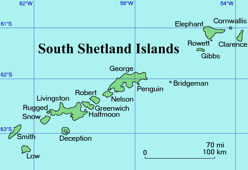
English: Map of the South Shetland Islands
Català: Mapa de les illes Shetland del Sud.
Deutsch: Karte der Südlichen Shetlandinseln
Español: Mapa de las Islas Shetland del Sur
Italiano: Una mappa delle Isole Shetland Meridionali
Русский: Карта Южных Шетландских островов (английский вариант)
Slovenščina: Zemljevid otočja |
| Date | Commons upload by Snowdog |
| Source |
Originally from en.wikipedia; description page is (was) here
|
| Author | User Topbanana on en.wikipedia |
| Permission (Reusing this file) |
PD-self |
| |
This work has been released into the public domain by its author, Topbanana, at the English Wikipedia project. This applies worldwide. In case this is not legally possible: |
File history
Click on a date/time to view the file as it appeared at that time.
| Date/Time | Thumbnail | Dimensions | User | Comment | |
|---|---|---|---|---|---|
| current | 20:11, 27 February 2005 | | 1,103 × 760 (35 KB) | Snowdog | Map of the South Shetland Islands |
File usage
The following file is a duplicate of this file (more details):
- File:South Shetland Islands Map.png from a shared repository
There are no pages that link to this file.