File:SkyrackHeadingley.jpg
From Wikishire

Size of this preview: 800 × 539 pixels. Other resolution: 320 × 216 pixels.
Original file (2,648 × 1,785 pixels, file size: 772 KB, MIME type: image/jpeg)
Summary
| Description |
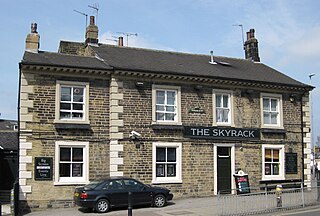
English: The Skyrack public house, 2 St Michael’s Road,Headingley, Leeds, LS6 3AW |
| Date | |
| Source | Own work |
| Author | Chemical Engineer |
| Camera location | | View this and other nearby images on: OpenStreetMap |
|---|
Licensing
| I, the copyright holder of this work, release this work into the public domain. This applies worldwide. In some countries this may not be legally possible; if so: I grant anyone the right to use this work for any purpose, without any conditions, unless such conditions are required by law. |
File history
Click on a date/time to view the file as it appeared at that time.
| Date/Time | Thumbnail | Dimensions | User | Comment | |
|---|---|---|---|---|---|
| current | 16:16, 20 May 2009 | | 2,648 × 1,785 (772 KB) | Chemical Engineer | {{Information |Description={{en|1=The Skyrack public house, 2 St Michael’s Road,Headingley, Leeds, LS6 3AW }} |Source=Own work by uploader |Author=Chemical Engineer |Date=2009-04-23 |Permission= |other_versions= }} {{Location |
File usage
The following file is a duplicate of this file (more details):
- File:SkyrackHeadingley.jpg from a shared repository
The following page links to this file: