File:Signy Island Panorama.jpg
From Wikishire

Size of this preview: 799 × 209 pixels. Other resolution: 320 × 84 pixels.
Original file (1,589 × 416 pixels, file size: 183 KB, MIME type: image/jpeg)
Summary
| Description |
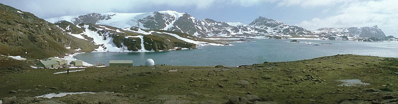
English: Signy Island (South Orkney Islands) the base and the bay |
| Date | |
| Source | Signy, the base and the bay |
| Author | Ben Tullis from Cambridge, United Kingdom |
| Camera location | | View this and other nearby images on: OpenStreetMap |
|---|
Licensing
This file is licensed under the Creative Commons Attribution 2.0 Generic license.
- You are free:
- to share – to copy, distribute and transmit the work
- to remix – to adapt the work
- Under the following conditions:
- attribution – You must give appropriate credit, provide a link to the license, and indicate if changes were made. You may do so in any reasonable manner, but not in any way that suggests the licensor endorses you or your use.
| This image was originally posted to Flickr by tullis at https://www.flickr.com/photos/7573630@N04/518454570. It was reviewed on 6 February 2009 by FlickreviewR and was confirmed to be licensed under the terms of the cc-by-2.0. |
File history
Click on a date/time to view the file as it appeared at that time.
| Date/Time | Thumbnail | Dimensions | User | Comment | |
|---|---|---|---|---|---|
| current | 12:27, 20 September 2018 | 1,589 × 416 (183 KB) | Brisbane | At least partially fixed the faulty panorama stiching of the original. Minor changes in colour and contrast. |
File usage
The following file is a duplicate of this file (more details):
- File:Signy Island Panorama.jpg from a shared repository
The following 3 pages link to this file: