File:Severn Aerial.jpg
From Wikishire
No higher resolution available.
Severn_Aerial.jpg (600 × 480 pixels, file size: 179 KB, MIME type: image/jpeg)
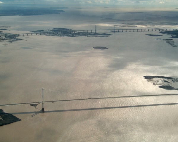
Aerial photograph of both Severn Bridges.
The older bridge is in the foreground.
by GRAHAMUK, September 2004
| This work has been released into the public domain by its author, GRAHAMUK at English Wikipedia. This applies worldwide. In some countries this may not be legally possible; if so: GRAHAMUK grants anyone the right to use this work for any purpose, without any conditions, unless such conditions are required by law. |
| Camera location | | View this and other nearby images on: OpenStreetMap |
|---|
File history
Click on a date/time to view the file as it appeared at that time.
| Date/Time | Thumbnail | Dimensions | User | Comment | |
|---|---|---|---|---|---|
| current | 22:09, 23 June 2010 | | 600 × 480 (179 KB) | Kingpin13 | remove aeroplane wing |
File usage
The following file is a duplicate of this file (more details):
- File:Severn Aerial.jpg from a shared repository
The following page links to this file: