File:Rockall EEZ.jpg
From Wikishire
Size of this preview: 623 × 600 pixels. Other resolution: 249 × 240 pixels.
Original file (864 × 832 pixels, file size: 97 KB, MIME type: image/jpeg)

|
File:Rockall EEZ map-en.svg is a vector version of this file. It should be used in place of this JPG file when not inferior.
File:Rockall EEZ.jpg → File:Rockall EEZ map-en.svg
For more information, see Help:SVG. |
 |
Summary
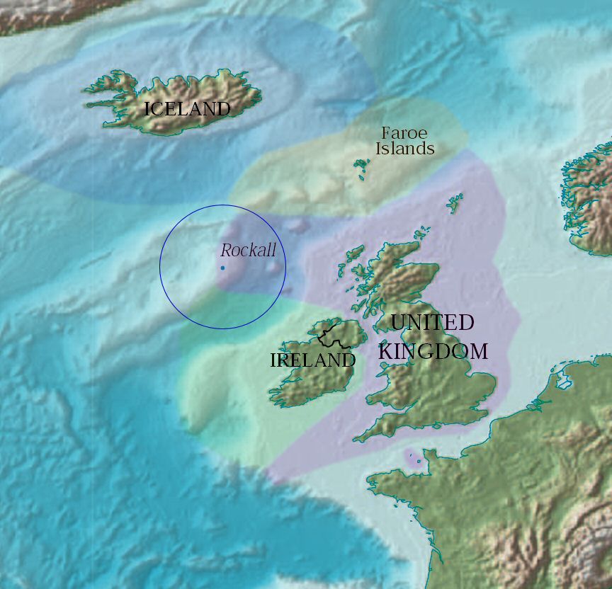
| Description | Map showing Rockall and the surrounding Exclusive Economic Zones of the UK, Republic of Ireland, the Faroe Islands (Denmark) and Iceland. The zones have been overlayed by Jooler using a CIA PD map. |
| Date | |
| Source | http://www.lib.utexas.edu/maps/world_maps/world_physical_2004.pdf |
| Author | Jooler |
| Other versions |
|
Licensing
This image is in the public domain because it contains materials that originally came from the United States Central Intelligence Agency's World Factbook.
|
 |
File history
Click on a date/time to view the file as it appeared at that time.
| Date/Time | Thumbnail | Dimensions | User | Comment | |
|---|---|---|---|---|---|
| current | 16:27, 26 April 2005 | | 864 × 832 (97 KB) | Jooler~commonswiki | Map showing Rockall and the surrounding Exclusive Economic Zones of the UK, Republic of Ireland, the Faroe Islands (Denmark) and Iceland. The zones have been overlayed by Jooler using a CIA PD map. It is part of the world map found at [http://www.lib.ute |
File usage
The following file is a duplicate of this file (more details):
- File:Rockall EEZ.jpg from a shared repository
The following page links to this file: