File:Petrel Island - Bay of Isles, South Georgia.svg
From Wikishire

Size of this preview: 626 × 449 pixels. Other resolution: 320 × 230 pixels.
Original file (SVG file, nominally 626 × 449 pixels, file size: 4.56 MB)
Summary
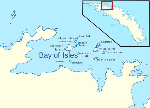
| Description | Location of Petrel Island in the Bay of Isles, South Georgia |
| Date | |
| Source | Bay of Isles - South Georgia coast.svg |
| Author | Hogweard |
| Permission (Reusing this file) |
This file is licensed under the Creative Commons Attribution 1.0 Generic license. Attribution: South Georgia GIS
|
File history
Click on a date/time to view the file as it appeared at that time.
| Date/Time | Thumbnail | Dimensions | User | Comment | |
|---|---|---|---|---|---|
| current | 20:13, 12 June 2020 | | 626 × 449 (4.56 MB) | Hogweard | == {{int:filedesc}} == {{Information |description=Location of Petrel Island in the Bay of Isles, South Georgia |date=2020-06-12 |source={{f|Bay of Isles - South Georgia coast.svg}} |author={{u|Hogweard}} |permission={{Cc-by-1.0|South Georgia GIS}} *Licence: [https://www.bas.ac.uk/project/sg-gis/#data South Georgia GIS] |other versions= }} Category:Maps of South Georgia Category:Bay of Isles |
File usage
The following file is a duplicate of this file (more details):
- File:Petrel Island - Bay of Isles, South Georgia.svg from a shared repository
The following page links to this file: