File:Packhorse Bridge - geograph.org.uk - 127538.jpg
From Wikishire
No higher resolution available.
Packhorse_Bridge_-_geograph.org.uk_-_127538.jpg (640 × 477 pixels, file size: 149 KB, MIME type: image/jpeg)
Summary
| Description |
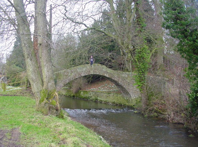
English: Wharton Bridge across the River Ive at Ivegill, Cumbria |
| Date | |
| Source | From geograph.org.uk |
| Author | Bob Jenkins |
| Attribution (required by the license) | Bob Jenkins / Packhorse Bridge / |
This is a photo of listed building number 1326713. |
| Camera location | | View this and other nearby images on: OpenStreetMap |
|---|
| Object location | | View this and other nearby images on: OpenStreetMap |
|---|
_&language=en)
Licensing

|
This image was taken from the Geograph project collection. See this photograph's page on the Geograph website for the photographer's contact details. The copyright on this image is owned by Bob Jenkins and is licensed for reuse under the Creative Commons Attribution-ShareAlike 2.0 license.
|
This file is licensed under the Creative Commons Attribution-Share Alike 2.0 Generic license.
Attribution: Bob Jenkins
- You are free:
- to share – to copy, distribute and transmit the work
- to remix – to adapt the work
- Under the following conditions:
- attribution – You must give appropriate credit, provide a link to the license, and indicate if changes were made. You may do so in any reasonable manner, but not in any way that suggests the licensor endorses you or your use.
- share alike – If you remix, transform, or build upon the material, you must distribute your contributions under the same or compatible license as the original.
File history
Click on a date/time to view the file as it appeared at that time.
| Date/Time | Thumbnail | Dimensions | User | Comment | |
|---|---|---|---|---|---|
| current | 04:10, 31 January 2010 | | 640 × 477 (149 KB) | GeographBot | == {{int:filedesc}} == {{Information |description={{en|1=Packhorse Bridge. Simply named Ivegill Bridge on maps, a local resident reckons it's "donkeys years" old...}} |date=2006-02-24 |source=From [http://www.geograph.org.uk/photo/127538 geograph.org.uk] |
File usage
The following file is a duplicate of this file (more details):
- File:Packhorse Bridge - geograph.org.uk - 127538.jpg from a shared repository
The following 3 pages link to this file: