File:Olympic aquatics centre, Lee Valley - geograph.org.uk - 2430541.jpg
From Wikishire

Size of this preview: 800 × 600 pixels. Other resolution: 320 × 240 pixels.
Original file (1,024 × 768 pixels, file size: 143 KB, MIME type: image/jpeg)
Summary
| Description |
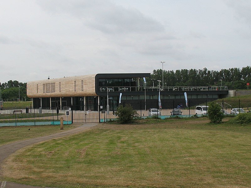
English: This building is the "main stand" referred to in the construction-strange photo TL3700 : Olympic White Water Canoe Centre. The aquatics centre (including white-water facilities) was built on Cheshunt Marsh, intended mainly for the London 2012 Olympics but by this time (May 2011) was already open to the public. |
| Date | |
| Source | From geograph.org.uk; transferred by User:Kafuffle using geograph_org2commons. |
| Author | Stephen Craven |
| Permission (Reusing this file) |
Creative Commons Attribution Share-alike license 2.0 |
| Attribution (required by the license) | Stephen Craven / Olympic aquatics centre, Lee Valley / |
| Camera location | | View this and other nearby images on: OpenStreetMap |
|---|
| Object location | | View this and other nearby images on: OpenStreetMap |
|---|
_region:GB-GBN_heading:180.00&language=en)
Licensing

|
This image was taken from the Geograph project collection. See this photograph's page on the Geograph website for the photographer's contact details. The copyright on this image is owned by Stephen Craven and is licensed for reuse under the Creative Commons Attribution-ShareAlike 2.0 license.
|
This file is licensed under the Creative Commons Attribution-Share Alike 2.0 Generic license.
Attribution: Stephen Craven
- You are free:
- to share – to copy, distribute and transmit the work
- to remix – to adapt the work
- Under the following conditions:
- attribution – You must give appropriate credit, provide a link to the license, and indicate if changes were made. You may do so in any reasonable manner, but not in any way that suggests the licensor endorses you or your use.
- share alike – If you remix, transform, or build upon the material, you must distribute your contributions under the same or compatible license as the original.
File history
Click on a date/time to view the file as it appeared at that time.
| Date/Time | Thumbnail | Dimensions | User | Comment | |
|---|---|---|---|---|---|
| current | 09:25, 10 July 2011 | | 1,024 × 768 (143 KB) | File Upload Bot (Magnus Manske) |
File usage
The following file is a duplicate of this file (more details):
- File:Olympic aquatics centre, Lee Valley - geograph.org.uk - 2430541.jpg from a shared repository
The following page links to this file: