File:Old Kirk Kilmacolm.jpg
From Wikishire
No higher resolution available.
Old_Kirk_Kilmacolm.jpg (640 × 473 pixels, file size: 195 KB, MIME type: image/jpeg)
| Description |
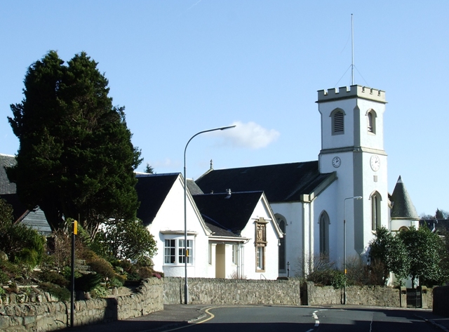
English: The Old Kirk, en:Kilmacolm's (en:Church of Scotland) parish church. Also visible on the left is the en:church hall, known as the Kidston Hall.
Taken from here. Photograph by Thomas Nugent. |
| Date | |
| Source | From geograph.org.uk |
| Author | Thomas Nugent |
| Permission (Reusing this file) |
Creative Commons Attribution Share-alike license 2.0 |
| Attribution (required by the license) | Thomas Nugent / Kilmacolm Old Kirk / |
| Camera location | | View this and other nearby images on: OpenStreetMap |
|---|

|
This image was taken from the Geograph project collection. See this photograph's page on the Geograph website for the photographer's contact details. The copyright on this image is owned by Thomas Nugent and is licensed for reuse under the Creative Commons Attribution-ShareAlike 2.0 license.
|
This file is licensed under the Creative Commons Attribution-Share Alike 2.0 Generic license.
Attribution: Thomas Nugent
- You are free:
- to share – to copy, distribute and transmit the work
- to remix – to adapt the work
- Under the following conditions:
- attribution – You must give appropriate credit, provide a link to the license, and indicate if changes were made. You may do so in any reasonable manner, but not in any way that suggests the licensor endorses you or your use.
- share alike – If you remix, transform, or build upon the material, you must distribute your contributions under the same or compatible license as the original.
Original upload log
The original description page was here. All following user names refer to en.wikipedia.
- 2007-09-10 06:38 Breadandcheese 640×473×??? (199884 bytes) The Old Kirk, [[Kilmacolm]]'s parish church. Taken from [https://www.geograph.org.uk/photo/355179 here]. Photograph by [https://www.geograph.org.uk/profile/4827 Thomas Nugent].
File history
Click on a date/time to view the file as it appeared at that time.
| Date/Time | Thumbnail | Dimensions | User | Comment | |
|---|---|---|---|---|---|
| current | 13:17, 25 September 2008 | | 640 × 473 (195 KB) | File Upload Bot (Magnus Manske) | {{BotMoveToCommons|en.wikipedia}} {{Information |Description={{en|The Old Kirk, en:Kilmacolm's (en:Church of Scotland) parish church. Also visible on the left is the en:church hall, known as the Kidston Hall. Taken from [http://www.geogra |
File usage
The following file is a duplicate of this file (more details):
- File:Old Kirk Kilmacolm.jpg from a shared repository
The following page links to this file: