File:North Tamerton Methodist Church - geograph.org.uk - 608593.jpg
From Wikishire
No higher resolution available.
North_Tamerton_Methodist_Church_-_geograph.org.uk_-_608593.jpg (640 × 423 pixels, file size: 47 KB, MIME type: image/jpeg)
Summary
| Description |
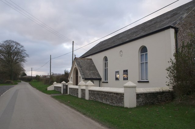
English: North Tamerton Methodist Church The church has two dates; a plaque on the porch reads "United Methodist Church 1869", while the one on the façade gives "Methodist Church 1932", so presumably one is the original building and the other a date of rebuilding or restoration. (The later one may just record the union of the United Methodists with the Methodist Church in 1932.) This is on the western outskirts of North Tamerton on the road to Wilsworthy Cross. |
| Date | |
| Source | From geograph.org.uk |
| Author | Derek Harper |
| Attribution (required by the license) | Derek Harper / North Tamerton Methodist Church / |
| Camera location | | View this and other nearby images on: OpenStreetMap |
|---|
_heading:292.00&language=en)
| Object location | | View this and other nearby images on: OpenStreetMap |
|---|
_heading:292.00&language=en)
Licensing

|
This image was taken from the Geograph project collection. See this photograph's page on the Geograph website for the photographer's contact details. The copyright on this image is owned by Derek Harper and is licensed for reuse under the Creative Commons Attribution-ShareAlike 2.0 license.
|
This file is licensed under the Creative Commons Attribution-Share Alike 2.0 Generic license.
Attribution: Derek Harper
- You are free:
- to share – to copy, distribute and transmit the work
- to remix – to adapt the work
- Under the following conditions:
- attribution – You must give appropriate credit, provide a link to the license, and indicate if changes were made. You may do so in any reasonable manner, but not in any way that suggests the licensor endorses you or your use.
- share alike – If you remix, transform, or build upon the material, you must distribute your contributions under the same or compatible license as the original.
File history
Click on a date/time to view the file as it appeared at that time.
| Date/Time | Thumbnail | Dimensions | User | Comment | |
|---|---|---|---|---|---|
| current | 23:51, 6 February 2011 | | 640 × 423 (47 KB) | GeographBot | == {{int:filedesc}} == {{Information |description={{en|1=North Tamerton Methodist Church The church has two dates; a plaque on the porch reads "United Methodist Church 1869", while the one on the façade gives "Methodist Church 1932", so presumably one is |
File usage
The following file is a duplicate of this file (more details):
- File:North Tamerton Methodist Church - geograph.org.uk - 608593.jpg from a shared repository
The following page links to this file: