File:Menstrie 1895.jpg

From Wikishire
Jump to: navigation, search
Original file(2,358 × 2,428 pixels, file size: 1.71 MB, MIME type: image/jpeg)

This file is from a shared repository and may be used by other projects. The description on its file description page there is shown below.

Summary

Description
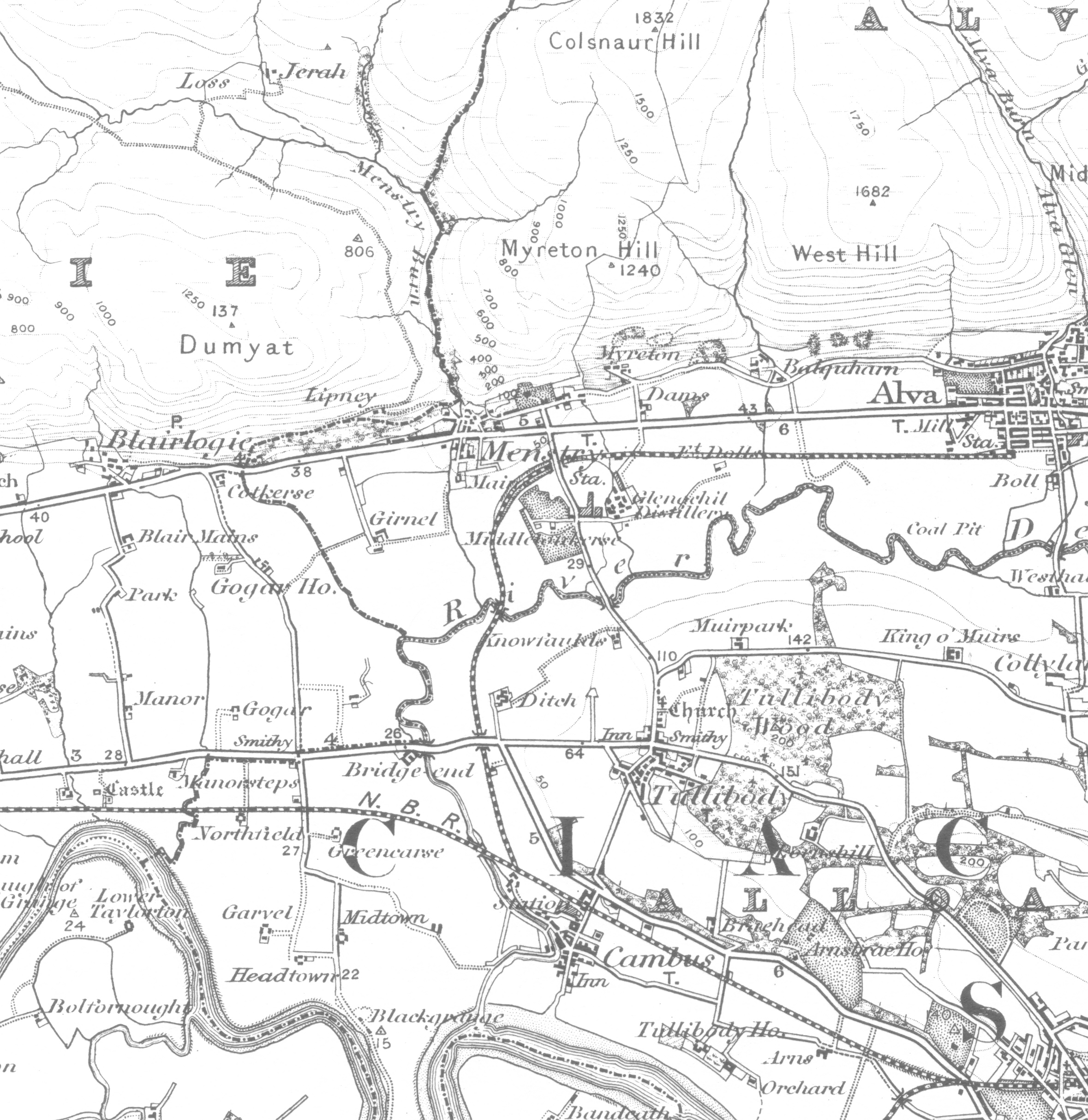
English: A portion of the OS sheet 39 - Stirling, 1 inch to 1 mile (1:63,360) Surveyed 1859 - 1863, published 1869, revised 1895, published 1897
Date
Source Ordnance Survey Office, Southampton, UK
Author Colonel J. Farquharson, C.B., R.E., Director General, 1897
Permission
(Reusing this file)
This work is an Ordnance Survey map over 50 years old, which is covered by Crown Copyright which in this case expires 50 years after publication. Ordnance Survey does however ask that they be credited and that the date of publication be given. Any ancillary rights gained through the creation of the electronic version are granted as freely usable under any circumstances.
Public domain
This work created by the United Kingdom Government is in the public domain.

This is because it is one of the following:

  1. It is a photograph taken prior to 1 June 1957; or
  2. It was published prior to 1974; or
  3. It is an artistic work other than a photograph or engraving (e.g. a painting) which was created prior to 1974.

HMSO has declared that the expiry of Crown Copyrights applies worldwide (ref: HMSO Email Reply)
More information.

See also Copyright and Crown copyright artistic works.

Deutsch  English  Español  français  italiano  Nederlands  polski  português  sicilianu  slovenščina  suomi  Türkçe  македонски  русский  українська  മലയാളം  한국어  日本語  简体中文  繁體中文  العربية  +/−

}

In addition to Menstrie ('Menstry'), the image shows Blairlogie, Cambus, Tullibody, and part of Alva.

Licensing

Public domain

This work is in the public domain in its country of origin and other countries and areas where the copyright term is the author's life plus 70 years or fewer.


You must also include a United States public domain tag to indicate why this work is in the public domain in the United States. Note that a few countries have copyright terms longer than 70 years: Mexico has 100 years, Jamaica has 95 years, Colombia has 80 years, and Guatemala and Samoa have 75 years. This image may not be in the public domain in these countries, which moreover do not implement the rule of the shorter term. Honduras has a general copyright term of 75 years, but it does implement the rule of the shorter term. Copyright may extend on works created by French who died for France in World War II (more information), Russians who served in the Eastern Front of World War II (known as the Great Patriotic War in Russia) and posthumously rehabilitated victims of Soviet repressions (more information).

Captions

Add a one-line explanation of what this file represents

Items portrayed in this file

depicts

1 January 1895Gregorian

File history

Click on a date/time to view the file as it appeared at that time.

Date/TimeThumbnailDimensionsUserComment
current21:08, 26 February 2010Thumbnail for version as of 21:08, 26 February 20102,358 × 2,428 (1.71 MB)Craig Omus{{Information |Description={{en|1=A portion of the OS sheet 39 - Stirling, 1 inch to 1 mile (1:63,360) Surveyed 1859 - 1863, published 1869, revised 1895, published 1897}} |Source=Ordnance Survey Office, Southampton, UK |Author=Colonel J. Farquharson, C.B

The following file is a duplicate of this file (more details):

The following page links to this file: