File:Map of Queen Elizabeth Land, BAT.svg
From Wikishire

Size of this preview: 486 × 484 pixels. Other resolution: 241 × 240 pixels.
Original file (SVG file, nominally 486 × 484 pixels, file size: 4.56 MB)
Summary
| Description |
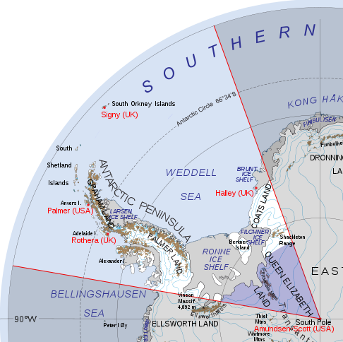
English: Map of British Antarctic Territory showing Queen Elizabeth Land |
|||||
| Date | ||||||
| Source | British Antarctic Territory (in Antarctica).svg | |||||
| Author |
|
|||||
| Permission (Reusing this file) |
|

.svg)
File history
Click on a date/time to view the file as it appeared at that time.
| Date/Time | Thumbnail | Dimensions | User | Comment | |
|---|---|---|---|---|---|
| current | 20:11, 25 January 2020 | | 486 × 484 (4.56 MB) | Hogweard | Typo |
File usage
The following file is a duplicate of this file (more details):
- File:Map of Queen Elizabeth Land, BAT.svg from a shared repository
The following page links to this file: