File:Map of Buckley.jpg
From Wikishire
Size of this preview: 337 × 599 pixels. Other resolution: 135 × 240 pixels.
Original file (1,520 × 2,703 pixels, file size: 1.18 MB, MIME type: image/jpeg)
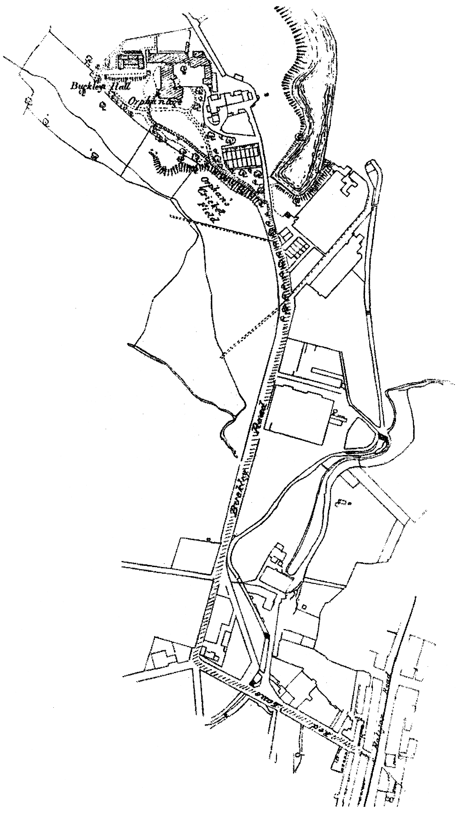
| Description | A map of Buckley, then in the Rochdale borough of Lancashire (now Greater Manchester), in North West England. | ||||
| Date | Bet. 1888 - 1947 | ||||
| Source | Pat Gallacher's Buckley Hall Orphanage Rochdale 1888 - 1947 (2003). | ||||
| Author | Ordnance Survey | ||||
| Permission (Reusing this file) |
|

File history
Click on a date/time to view the file as it appeared at that time.
| Date/Time | Thumbnail | Dimensions | User | Comment | |
|---|---|---|---|---|---|
| current | 20:42, 14 July 2010 | | 1,520 × 2,703 (1.18 MB) | Jza84 | {{Information |Description=A map of Buckley, then in the Rochdale borough of Lancashire (now Greater Manchester), in North West England. |Source=Pat Gallacher's ''Buckley Hall Orphanage Rochdale 1888 - 1947'' (2003). |Date=Bet. 1888 - 1947 |Author=Ordnan |
File usage
The following file is a duplicate of this file (more details):
- File:Map of Buckley.jpg from a shared repository
The following page links to this file: