File:Map Londinium 400 AD-en.svg
From Wikishire

Size of this preview: 598 × 599 pixels. Other resolution: 240 × 240 pixels.
Original file (SVG file, nominally 996 × 998 pixels, file size: 742 KB)
Summary
| Description |
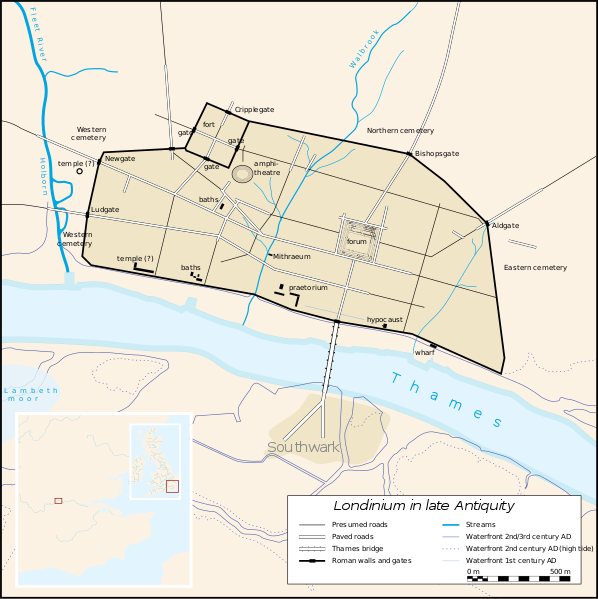
English: An anachronistic map of Roman London (Londinium) in late Antiquity (2nd-5th c.) |
| Date | |
| Source | http://upload.wikimedia.org/wikipedia/commons/5/59/Map_Londinium_400_AD-de.svg |
| Author | Fremantleboy, Drallim (translation) |
Licensing
This file is licensed under the Creative Commons Attribution 2.5 Generic license.
- You are free:
- to share – to copy, distribute and transmit the work
- to remix – to adapt the work
- Under the following conditions:
- attribution – You must give appropriate credit, provide a link to the license, and indicate if changes were made. You may do so in any reasonable manner, but not in any way that suggests the licensor endorses you or your use.
| Annotations | This image is annotated: View the annotations at Commons |
File history
Click on a date/time to view the file as it appeared at that time.
| Date/Time | Thumbnail | Dimensions | User | Comment | |
|---|---|---|---|---|---|
| current | 22:52, 16 March 2013 | | 996 × 998 (742 KB) | Drallim | User created page with UploadWizard |
File usage
The following file is a duplicate of this file (more details):
- File:Map Londinium 400 AD-en.svg from a shared repository
The following 2 pages link to this file: