File:London Ringway 4 1960s Plan.png
From Wikishire
Size of this preview: 600 × 600 pixels. Other resolution: 240 × 240 pixels.
Original file (1,871 × 1,871 pixels, file size: 460 KB, MIME type: image/png)
| Description |
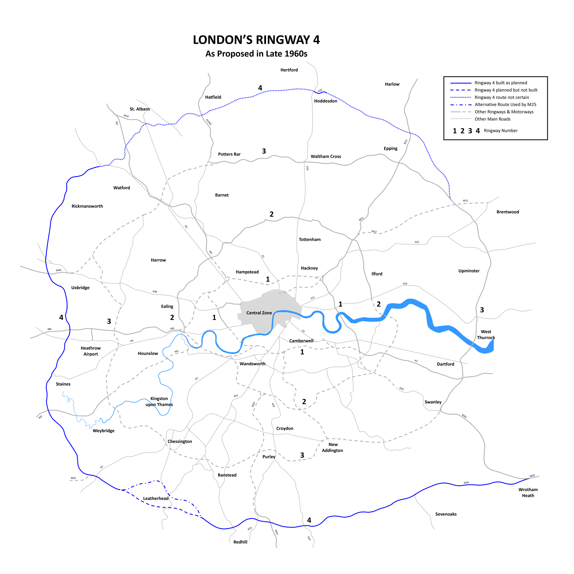
English: London Ringway 4 Plan from the late 1960s showing roads planned for Ringway 4, indicating those sections of road that were built (becoming parts of the M25 motorway and M26 motorway) and those sections not built. --DavidCane 15:32, 4 February 2007 (UTC) |
| Date | 2 March 2008 (original upload date) |
| Source | Transferred from en.wikipedia to Commons by Oxyman using CommonsHelper. |
| Author | DavidCane at English Wikipedia |
Licensing
DavidCane at the English-language Wikipedia, the copyright holder of this work, hereby publishes it under the following license:
| This file is licensed under the Creative Commons Attribution-Share Alike 3.0 Unported license. Subject to disclaimers. | ||
| Attribution: DavidCane at the English-language Wikipedia | ||
| ||
| This licensing tag was added to this file as part of the GFDL licensing update. |

|
Permission is granted to copy, distribute and/or modify this document under the terms of the GNU Free Documentation License, Version 1.2 or any later version published by the Free Software Foundation; with no Invariant Sections, no Front-Cover Texts, and no Back-Cover Texts. A copy of the license is included in the section entitled GNU Free Documentation License. Subject to disclaimers. |
Original upload log
The original description page was here. All following user names refer to en.wikipedia.
- 2008-03-02 00:34 DavidCane 1871×1871× (470752 bytes) Revised to correct Wrotham Green to Wrotham Heath
- 2007-04-01 01:45 DavidCane 1871×1871× (470067 bytes) Revised to correct spelling and to add M31
- 2007-02-04 15:34 DavidCane 1871×1871× (482300 bytes)
File history
Click on a date/time to view the file as it appeared at that time.
| Date/Time | Thumbnail | Dimensions | User | Comment | |
|---|---|---|---|---|---|
| current | 19:30, 15 September 2009 | | 1,871 × 1,871 (460 KB) | File Upload Bot (Magnus Manske) | {{BotMoveToCommons|en.wikipedia|year={{subst:CURRENTYEAR}}|month={{subst:CURRENTMONTHNAME}}|day={{subst:CURRENTDAY}}}} {{Information |Description={{en|London Ringway 4 Plan from the late 1960s showing roads planned for en:Ringway 4, indicating thos |
File usage
The following file is a duplicate of this file (more details):
- File:London Ringway 4 1960s Plan.png from a shared repository
The following page links to this file: