File:Lingay (Barra).svg
From Wikishire

Size of this preview: 215 × 190 pixels. Other resolution: 272 × 240 pixels.
Original file (SVG file, nominally 215 × 190 pixels, file size: 2.52 MB)
.svg)
Summary
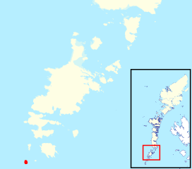
| Description | Location of Lingay (the isle south of Barra) in relation to Barra in the Outer Hebrides (Inverness-shire) |
| Date | |
| Source | Orosay (Barra).svg |
| Author | Hogweard |
| Permission (Reusing this file) |
This file is licensed under the Creative Commons Attribution-Share Alike 3.0 Unported license. Attribution: Contains Ordnance Survey data © Crown copyright and database right
|
.svg)
File history
Click on a date/time to view the file as it appeared at that time.
| Date/Time | Thumbnail | Dimensions | User | Comment | |
|---|---|---|---|---|---|
| current | 22:59, 22 March 2020 | | 215 × 190 (2.52 MB) | Hogweard | == {{int:filedesc}} == {{Information |description=Location of Lingay (the isle south of Barra) in relation to Barra in the Outer Hebrides (Inverness-shire) |date=2020-03-22 |source={{f|Orosay (Barra).svg}} |author={{u|Hogweard}} |permission={{cc-by-sa-3.0|1=Contains Ordnance Survey data © Crown copyright and database right}} |other versions= }} Category:Locator maps of the Outer Hebrides |
File usage
The following file is a duplicate of this file (more details):
.svg)
- File:Lingay (Barra).svg from a shared repository
The following page links to this file:
.svg)
.svg)
.svg&action=edit&redlink=1)
.svg)
.svg&printable=yes)
.svg&action=info)