File:Kingdom of Osraige-900.svg
From Wikishire

Size of this preview: 460 × 600 pixels. Other resolution: 184 × 240 pixels.
Original file (SVG file, nominally 633 × 825 pixels, file size: 685 KB)
Created by User:ZyMOS for Wiki Atlas of World History[dead link]
Derived from:
Summary
| Description |
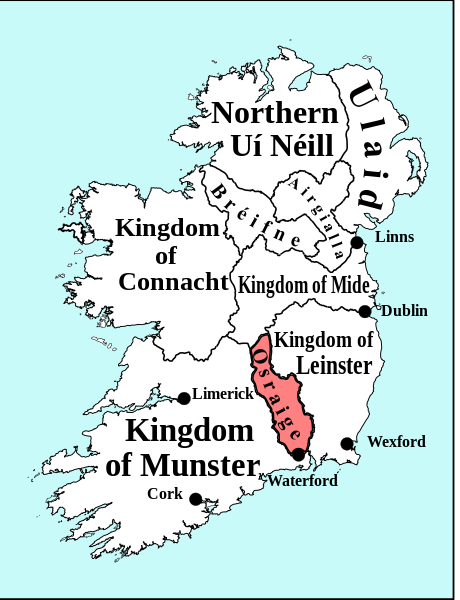
English: SVG map of Ireland circa 900 to accompany an article on Early Scandinavian Dublin, containing place names, territories and battlefields mentioned in that article. |
| Date | |
| Source | Own work |
| Author | Erigena |
Licensing
| I, the copyright holder of this work, release this work into the public domain. This applies worldwide. In some countries this may not be legally possible; if so: I grant anyone the right to use this work for any purpose, without any conditions, unless such conditions are required by law. |
File history
Click on a date/time to view the file as it appeared at that time.
| Date/Time | Thumbnail | Dimensions | User | Comment | |
|---|---|---|---|---|---|
| current | 03:16, 2 March 2011 | | 633 × 825 (685 KB) | ZyMOS | Created by User:ZyMOS for [http://historyatlas.wikia.com/wiki Wiki Atlas of World History] Category:Wiki Atlas of World History Derived from: == {{int:filedesc}} == {{Information |Description={{en|1=SVG map of Ireland circa 900 to accompany an ar |
File usage
The following file is a duplicate of this file (more details):
- File:Kingdom of Osraige-900.svg from a shared repository
The following page links to this file: