File:Jackfield Level Crossing - geograph.org.uk - 177191.jpg
From Wikishire
No higher resolution available.
Jackfield_Level_Crossing_-_geograph.org.uk_-_177191.jpg (640 × 480 pixels, file size: 159 KB, MIME type: image/jpeg)
Summary
| Description |
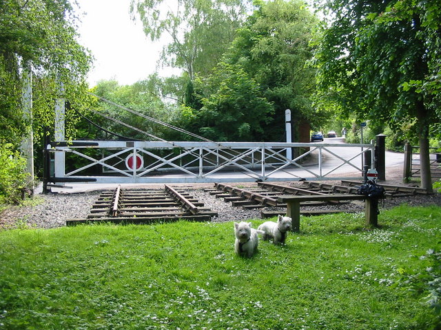
English: Jackfield Level Crossing. This level crossing at Jackfield is on the route of the former Severn Valley Railway that ran between Worcester and Shrewsbury through the Ironbridge Gorge. This part of the railway is long gone but the crossing gates have been preserved as a feature on what is now a cycling trail. |
| Date | |
| Source | From geograph.org.uk |
| Author | Mike Bardill |
| Attribution (required by the license) | Mike Bardill / Jackfield Level Crossing / |
| Camera location | | View this and other nearby images on: OpenStreetMap |
|---|
_heading:112.00&language=en)
| Object location | | View this and other nearby images on: OpenStreetMap |
|---|
_heading:112.00&language=en)
Licensing

|
This image was taken from the Geograph project collection. See this photograph's page on the Geograph website for the photographer's contact details. The copyright on this image is owned by Mike Bardill and is licensed for reuse under the Creative Commons Attribution-ShareAlike 2.0 license.
|
This file is licensed under the Creative Commons Attribution-Share Alike 2.0 Generic license.
Attribution: Mike Bardill
- You are free:
- to share – to copy, distribute and transmit the work
- to remix – to adapt the work
- Under the following conditions:
- attribution – You must give appropriate credit, provide a link to the license, and indicate if changes were made. You may do so in any reasonable manner, but not in any way that suggests the licensor endorses you or your use.
- share alike – If you remix, transform, or build upon the material, you must distribute your contributions under the same or compatible license as the original.
File history
Click on a date/time to view the file as it appeared at that time.
| Date/Time | Thumbnail | Dimensions | User | Comment | |
|---|---|---|---|---|---|
| current | 14:12, 31 January 2010 | | 640 × 480 (159 KB) | GeographBot | == {{int:filedesc}} == {{Information |description={{en|1=Jackfield Level Crossing. This level crossing at Jackfield is on the route of the former Severn Valley Railway that ran between Worcester and Shrewsbury through the Ironbridge Gorge. This part of t |
File usage
The following file is a duplicate of this file (more details):
- File:Jackfield Level Crossing - geograph.org.uk - 177191.jpg from a shared repository
The following page links to this file: