File:Ireland900.png
From Wikishire
Size of this preview: 469 × 599 pixels. Other resolution: 188 × 240 pixels.
Original file (2,060 × 2,630 pixels, file size: 512 KB, MIME type: image/png)
Summary
| Description |
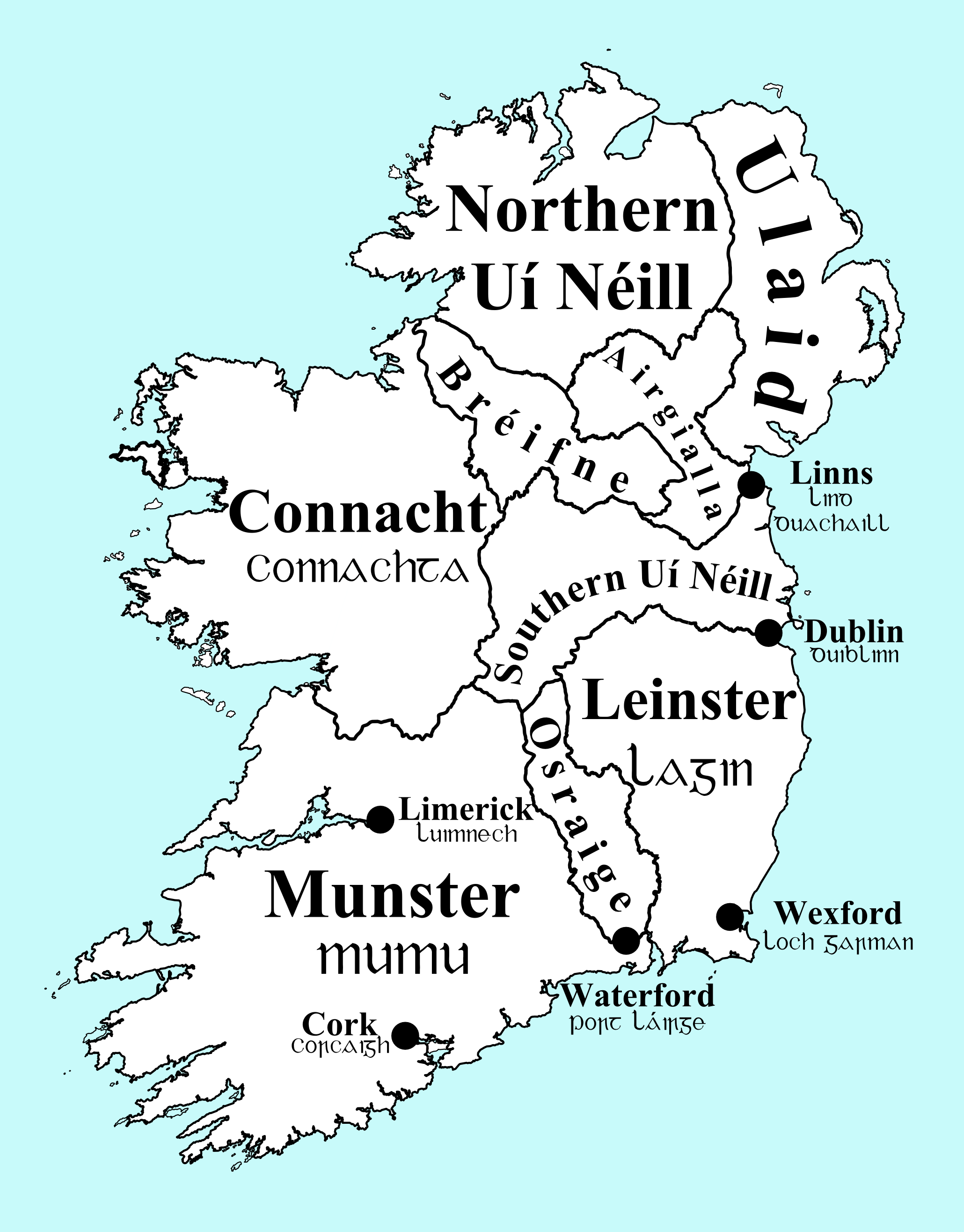
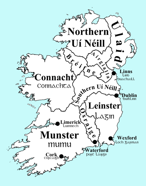
English: Map of Ireland, circa 900, with overkingdoms and principal (Viking) towns indicated.
Português: Mapa de Irlanda, perto do ano 900, ilustrando os reinos e principais cidades da época. |
| Date | |
| Source | Own work |
| Author | Erakis |
| Other versions | Ireland900.svg |
Licensing
| I, the copyright holder of this work, release this work into the public domain. This applies worldwide. In some countries this may not be legally possible; if so: I grant anyone the right to use this work for any purpose, without any conditions, unless such conditions are required by law. |
File history
Click on a date/time to view the file as it appeared at that time.
| Date/Time | Thumbnail | Dimensions | User | Comment | |
|---|---|---|---|---|---|
| current | 22:44, 22 December 2013 | | 2,060 × 2,630 (512 KB) | Ras67 | cropped |
File usage
The following file is a duplicate of this file (more details):
- File:Ireland900.png from a shared repository
The following page links to this file: