File:Inner Tower, Camber Castle - geograph.org.uk - 361150.jpg
From Wikishire

Size of this preview: 449 × 600 pixels. Other resolution: 179 × 240 pixels.
Original file (479 × 640 pixels, file size: 168 KB, MIME type: image/jpeg)
Summary
| Description |
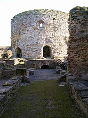
English: Inner Tower, Camber Castle This was the original tower built by Sir Edward Guldeford in 1514 upgraded and made taller when the rest of the castle was constructed between 1539 and 1544. The castle is currently only open to the public on limited weekends during the summer though the outside is accessible all year round as is peering through the gates and windows. |
| Date | |
| Source | From geograph.org.uk |
| Author | Simon Carey |
| Attribution (required by the license) | Simon Carey / Inner Tower, Camber Castle / |
| Camera location | | View this and other nearby images on: OpenStreetMap |
|---|
_heading:112.00&language=en)
| Object location | | View this and other nearby images on: OpenStreetMap |
|---|
_heading:112.00&language=en)
Licensing

|
This image was taken from the Geograph project collection. See this photograph's page on the Geograph website for the photographer's contact details. The copyright on this image is owned by Simon Carey and is licensed for reuse under the Creative Commons Attribution-ShareAlike 2.0 license.
|
This file is licensed under the Creative Commons Attribution-Share Alike 2.0 Generic license.
Attribution: Simon Carey
- You are free:
- to share – to copy, distribute and transmit the work
- to remix – to adapt the work
- Under the following conditions:
- attribution – You must give appropriate credit, provide a link to the license, and indicate if changes were made. You may do so in any reasonable manner, but not in any way that suggests the licensor endorses you or your use.
- share alike – If you remix, transform, or build upon the material, you must distribute your contributions under the same or compatible license as the original.
File history
Click on a date/time to view the file as it appeared at that time.
| Date/Time | Thumbnail | Dimensions | User | Comment | |
|---|---|---|---|---|---|
| current | 17:24, 4 January 2011 | | 479 × 640 (168 KB) | GeographBot | == {{int:filedesc}} == {{Information |description={{en|1=Inner Tower, Camber Castle This was the original tower built by Sir Edward Guldeford in 1514 upgraded and made taller when the rest of the castle was constructed between 1539 and 1544. The castle is |
File usage
The following file is a duplicate of this file (more details):
- File:Inner Tower, Camber Castle - geograph.org.uk - 361150.jpg from a shared repository
The following page links to this file: