File:Ingleton WTL.svg
From Wikishire

Size of this preview: 640 × 480 pixels. Other resolution: 320 × 240 pixels.
Original file (SVG file, nominally 640 × 480 pixels, file size: 234 KB)
Summary
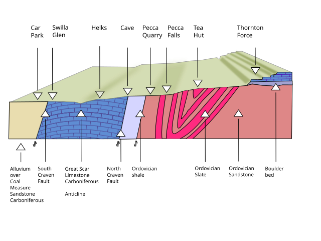
| Description | Geological cross section of strata along the Ingleton Waterfalls Trail |
| Date | |
| Source |
I, the copyright holder of this work, hereby publish it under the following license: |
| Author | Clem Rutter, Rochester, Kent. |
| Camera location | | View this and other nearby images on: OpenStreetMap |
|---|
Licensing
I, the copyright holder of this work, hereby publish it under the following license:
This file is licensed under the Creative Commons Attribution 3.0 Unported license.
- You are free:
- to share – to copy, distribute and transmit the work
- to remix – to adapt the work
- Under the following conditions:
- attribution – You must give appropriate credit, provide a link to the license, and indicate if changes were made. You may do so in any reasonable manner, but not in any way that suggests the licensor endorses you or your use.
File history
Click on a date/time to view the file as it appeared at that time.
| Date/Time | Thumbnail | Dimensions | User | Comment | |
|---|---|---|---|---|---|
| current | 10:08, 7 March 2014 | | 640 × 480 (234 KB) | ClemRutter |
File usage
The following file is a duplicate of this file (more details):
- File:Ingleton WTL.svg from a shared repository
The following 2 pages link to this file: