File:Historical and Topographical Description of the Channel Islands 1840 Robert Mudie 10.jpg

| Description |
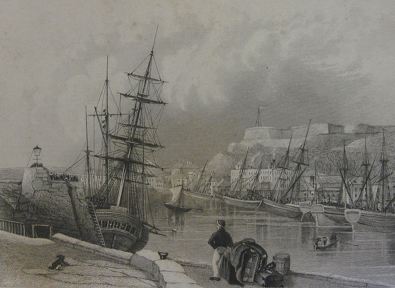
English: Illustration from Historical and Topographical Description of the Channel Islands (1840) by Robert Mudie - "St. Helier's, Jersey" |
||||
| Date | |||||
| Source | own photo of 19th century guidebook illustration | ||||
| Author | Man vyi | ||||
| Permission (Reusing this file) |
Own work, all rights released (Public domain) | ||||
| I, the copyright holder of this work, release this work into the public domain. This applies worldwide. In some countries this may not be legally possible; if so: I grant anyone the right to use this work for any purpose, without any conditions, unless such conditions are required by law. |
| Annotations | This image is annotated: View the annotations at Commons |
File history
Click on a date/time to view the file as it appeared at that time.
| Date/Time | Thumbnail | Dimensions | User | Comment | |
|---|---|---|---|---|---|
| current | 16:13, 3 October 2009 | | 2,485 × 1,811 (4.11 MB) | Man vyi | {{Information |Description={{PD-old}} {{en|Illustration from ''Historical and Topographical Description of the Channel Islands'' (1840) by Robert Mudie - "St. Helier's, Jersey"}} |Source=own photo of 19th century guidebook illustration |Date=2 d'Octob |
File usage
The following file is a duplicate of this file (more details):
- File:Historical and Topographical Description of the Channel Islands 1840 Robert Mudie 10.jpg from a shared repository
The following page links to this file: