File:High Street, Much Hadham, Hertfordshire - geograph.org.uk - 144767.jpg
From Wikishire
No higher resolution available.
High_Street,_Much_Hadham,_Hertfordshire_-_geograph.org.uk_-_144767.jpg (640 × 480 pixels, file size: 77 KB, MIME type: image/jpeg)
Summary
| Description |
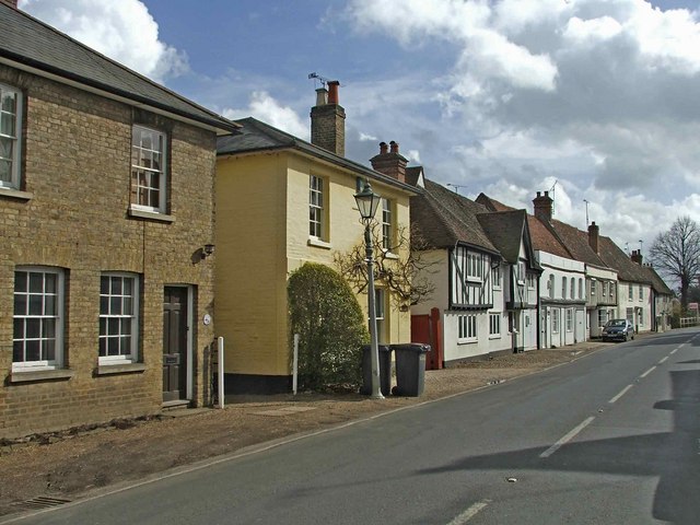
English: High Street, Much Hadham, Hertfordshire. High Street in Much Hadham. GREAT (or Much) HADHAM is an ancient town with a station on the Buntingford branch railway, In Edwinstree hundred, Bishop's Stortford union and county court district, rural deanery of Bishop's Stortford, and deaconry and diocese of St Albans, 5 miles west of Bishop's Stortford, 9 north-east of Hertford and 25 from London; it is lighted by gas. Much Hadham has often won the prize for the Best Kept Village in Hertfordshire. |
| Date | |
| Source | From geograph.org.uk |
| Author | Christine Matthews |
| Attribution (required by the license) | Christine Matthews / High Street, Much Hadham, Hertfordshire / |
| Object location | | View this and other nearby images on: OpenStreetMap |
|---|
_&language=en)
Licensing

|
This image was taken from the Geograph project collection. See this photograph's page on the Geograph website for the photographer's contact details. The copyright on this image is owned by Christine Matthews and is licensed for reuse under the Creative Commons Attribution-ShareAlike 2.0 license.
|
This file is licensed under the Creative Commons Attribution-Share Alike 2.0 Generic license.
Attribution: Christine Matthews
- You are free:
- to share – to copy, distribute and transmit the work
- to remix – to adapt the work
- Under the following conditions:
- attribution – You must give appropriate credit, provide a link to the license, and indicate if changes were made. You may do so in any reasonable manner, but not in any way that suggests the licensor endorses you or your use.
- share alike – If you remix, transform, or build upon the material, you must distribute your contributions under the same or compatible license as the original.
File history
Click on a date/time to view the file as it appeared at that time.
| Date/Time | Thumbnail | Dimensions | User | Comment | |
|---|---|---|---|---|---|
| current | 07:19, 31 January 2010 | | 640 × 480 (77 KB) | GeographBot | == {{int:filedesc}} == {{Information |description={{en|1=High Street, Much Hadham, Hertfordshire. High Street in Much Hadham. GREAT (or Much) HADHAM is an ancient town with a station on the Buntingford branch railway, In Edwinstree hundred, Bishop's Stor |
File usage
The following file is a duplicate of this file (more details):
- File:High Street, Much Hadham, Hertfordshire - geograph.org.uk - 144767.jpg from a shared repository
The following page links to this file: