File:High Force 7190.JPG
From Wikishire

Size of this preview: 800 × 600 pixels. Other resolution: 320 × 240 pixels.
Original file (3,488 × 2,616 pixels, file size: 2.04 MB, MIME type: image/jpeg)
Summary
| Description |
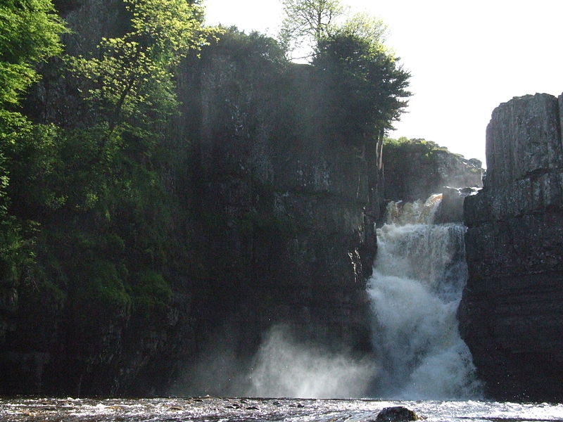
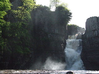
High Force is a waterfall on the River Tees, near Middleton-in-Teesdale, Teesdale, County Durham , England. The waterfall is within the North Pennines Area of Outstanding Natural Beauty (AONB) and European Geopark. The whole of the River Tees plunges 21.5 metres (71 ft) over a precipice (cliff edge which is almost vertical). High Force was formed where the River Tees crosses the Whin Sill. |
| Date | |
| Source | Own work |
| Author | Clem Rutter, Rochester, Kent |
| Camera location | | View this and other nearby images on: OpenStreetMap |
|---|
Licensing
I, the copyright holder of this work, hereby publish it under the following licenses:

|
Permission is granted to copy, distribute and/or modify this document under the terms of the GNU Free Documentation License, Version 1.2 or any later version published by the Free Software Foundation; with no Invariant Sections, no Front-Cover Texts, and no Back-Cover Texts. A copy of the license is included in the section entitled GNU Free Documentation License. |
This file is licensed under the Creative Commons Attribution 3.0 Unported license.
- You are free:
- to share – to copy, distribute and transmit the work
- to remix – to adapt the work
- Under the following conditions:
- attribution – You must give appropriate credit, provide a link to the license, and indicate if changes were made. You may do so in any reasonable manner, but not in any way that suggests the licensor endorses you or your use.
You may select the license of your choice.
File history
Click on a date/time to view the file as it appeared at that time.
| Date/Time | Thumbnail | Dimensions | User | Comment | |
|---|---|---|---|---|---|
| current | 11:37, 19 June 2011 | | 3,488 × 2,616 (2.04 MB) | ClemRutter |
File usage
The following file is a duplicate of this file (more details):
- File:High Force 7190.JPG from a shared repository
The following page links to this file: