File:Harrold Village Green - geograph.org.uk - 278579.jpg
From Wikishire
No higher resolution available.
Harrold_Village_Green_-_geograph.org.uk_-_278579.jpg (640 × 480 pixels, file size: 180 KB, MIME type: image/jpeg)
Summary
| Description |
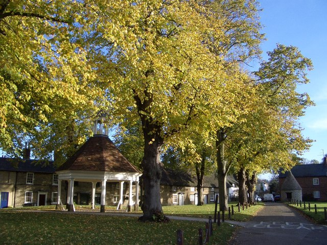
English: Harrold Village Green, near to Harrold, Bedfordshire, Great Britain.
The tree-lined village green includes a war memorial (not shown), an early 18th-century market house and a circular village lock-up built in 1824. The latter two are both Grade II listed. |
| Date | |
| Source | From geograph.org.uk; transferred by User:Skinsmoke using geograph_org2commons. |
| Author | Nigel Stickells |
| Permission (Reusing this file) |
Creative Commons Attribution Share-alike license 2.0 |
| Attribution (required by the license) | Nigel Stickells / Harrold Village Green / |
| Camera location | | View this and other nearby images on: OpenStreetMap |
|---|
| Object location | | View this and other nearby images on: OpenStreetMap |
|---|
_region:GB-GBN_heading:225.00&language=en)
Licensing

|
This image was taken from the Geograph project collection. See this photograph's page on the Geograph website for the photographer's contact details. The copyright on this image is owned by Nigel Stickells and is licensed for reuse under the Creative Commons Attribution-ShareAlike 2.0 license.
|
This file is licensed under the Creative Commons Attribution-Share Alike 2.0 Generic license.
Attribution: Nigel Stickells
- You are free:
- to share – to copy, distribute and transmit the work
- to remix – to adapt the work
- Under the following conditions:
- attribution – You must give appropriate credit, provide a link to the license, and indicate if changes were made. You may do so in any reasonable manner, but not in any way that suggests the licensor endorses you or your use.
- share alike – If you remix, transform, or build upon the material, you must distribute your contributions under the same or compatible license as the original.
File history
Click on a date/time to view the file as it appeared at that time.
| Date/Time | Thumbnail | Dimensions | User | Comment | |
|---|---|---|---|---|---|
| current | 12:00, 16 October 2010 | | 640 × 480 (180 KB) | File Upload Bot (Magnus Manske) |
File usage
The following file is a duplicate of this file (more details):
- File:Harrold Village Green - geograph.org.uk - 278579.jpg from a shared repository
The following page links to this file: