File:Grimes Graves , neolithic flint mine - geograph.org.uk - 1007207.jpg
From Wikishire
No higher resolution available.
Grimes_Graves_,_neolithic_flint_mine_-_geograph.org.uk_-_1007207.jpg (640 × 480 pixels, file size: 101 KB, MIME type: image/jpeg)
Summary
| Description |
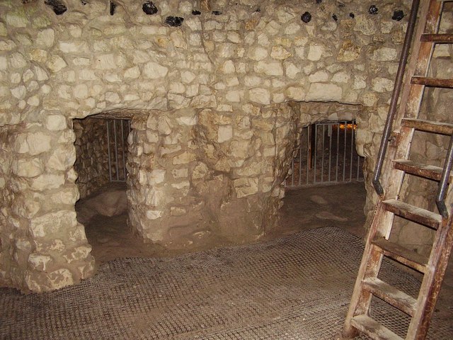
English: Grimes Graves , neolithic flint mine The excavated pit of a flint mine at Grimes Graves, a layer of chalk a few feet under ground attracted the miners.
The site is managed by English Heritage and one pit is open, another is scientific. The site is quiet and tranquil and well worth the visit. |
| Date | |
| Source | From geograph.org.uk |
| Author | Ashley Dace |
| Camera location | | View this and other nearby images on: OpenStreetMap |
|---|
_heading:90.00&language=en)
| Object location | | View this and other nearby images on: OpenStreetMap |
|---|
_heading:90.00&language=en)
Licensing

|
This image was taken from the Geograph project collection. See this photograph's page on the Geograph website for the photographer's contact details. The copyright on this image is owned by Ashley Dace and is licensed for reuse under the Creative Commons Attribution-ShareAlike 2.0 license.
|
This file is licensed under the Creative Commons Attribution-Share Alike 2.0 Generic license.
Attribution: Ashley Dace
- You are free:
- to share – to copy, distribute and transmit the work
- to remix – to adapt the work
- Under the following conditions:
- attribution – You must give appropriate credit, provide a link to the license, and indicate if changes were made. You may do so in any reasonable manner, but not in any way that suggests the licensor endorses you or your use.
- share alike – If you remix, transform, or build upon the material, you must distribute your contributions under the same or compatible license as the original.
File history
Click on a date/time to view the file as it appeared at that time.
| Date/Time | Thumbnail | Dimensions | User | Comment | |
|---|---|---|---|---|---|
| current | 07:26, 23 February 2011 | | 640 × 480 (101 KB) | GeographBot | == {{int:filedesc}} == {{Information |description={{en|1=Grimes Graves , neolithic flint mine The excavated pit of a flint mine at Grimes Graves, a layer of chalk a few feet under ground attracted the miners. The site is managed by English Heritage and |
File usage
The following file is a duplicate of this file (more details):
- File:Grimes Graves , neolithic flint mine - geograph.org.uk - 1007207.jpg from a shared repository
The following page links to this file: