File:Glandy Cross and the Cross Inn - geograph.org.uk - 1707476.jpg
Summary
| Description |
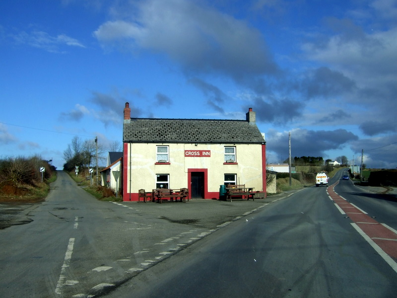
English: Glandy Cross and the Cross Inn The pub faces the road intersection that the village is named for: on the right is the A478 old turnpike route heading towards Cardigan, left the minor road to Mynachclogddu. Roads also run west and east at this point.
Although this is on the surface this looks a somewhat dull, flat landscape it has important prehistoric and historic roots: there is a multiplicity of Neolithic and Bronze Age remains in the area still visible, and in the Middle Ages the land (much of it owned by the Cistercians at Whitland Abbey) was held under Welsh systems of tenure and farmed communally. "Sixteenth-century leases make it clear that tenants were practising common pasturage and the survival of arian y mynydd or 'mountain silver', a payment for grazing rights, with a diversity of rents, in both cash, kind and service, suggests that they correspond with earlier villein obligations, when most of the tenants were also bound to do boon work for the monastery." Some of the moorland here remained unenclosed until the C19. See Archaeology in Wales http://www.cambria.org.uk/HLC/Preseli/area/area265.htm |
| Date | |
| Source | From geograph.org.uk |
| Author | ceridwen |
| Attribution (required by the license) | ceridwen / Glandy Cross and the Cross Inn / |
| Camera location | | View this and other nearby images on: OpenStreetMap |
|---|
_heading:45.00&language=en)
| Object location | | View this and other nearby images on: OpenStreetMap |
|---|
_heading:45.00&language=en)
Licensing

|
This image was taken from the Geograph project collection. See this photograph's page on the Geograph website for the photographer's contact details. The copyright on this image is owned by ceridwen and is licensed for reuse under the Creative Commons Attribution-ShareAlike 2.0 license.
|
- You are free:
- to share – to copy, distribute and transmit the work
- to remix – to adapt the work
- Under the following conditions:
- attribution – You must give appropriate credit, provide a link to the license, and indicate if changes were made. You may do so in any reasonable manner, but not in any way that suggests the licensor endorses you or your use.
- share alike – If you remix, transform, or build upon the material, you must distribute your contributions under the same or compatible license as the original.
File history
Click on a date/time to view the file as it appeared at that time.
| Date/Time | Thumbnail | Dimensions | User | Comment | |
|---|---|---|---|---|---|
| current | 05:06, 5 March 2011 | | 800 × 600 (137 KB) | GeographBot | == {{int:filedesc}} == {{Information |description={{en|1=Glandy Cross and the Cross Inn The pub faces the road intersection that the village is named for: on the right is the A478 old turnpike route heading towards Cardigan, left the minor road to Mynachc |
File usage
The following file is a duplicate of this file (more details):
- File:Glandy Cross and the Cross Inn - geograph.org.uk - 1707476.jpg from a shared repository
The following page links to this file: