File:GillinghamGreatLines2718.JPG
From Wikishire

Size of this preview: 800 × 600 pixels. Other resolution: 320 × 240 pixels.
Original file (2,016 × 1,512 pixels, file size: 935 KB, MIME type: image/jpeg)
| Description |
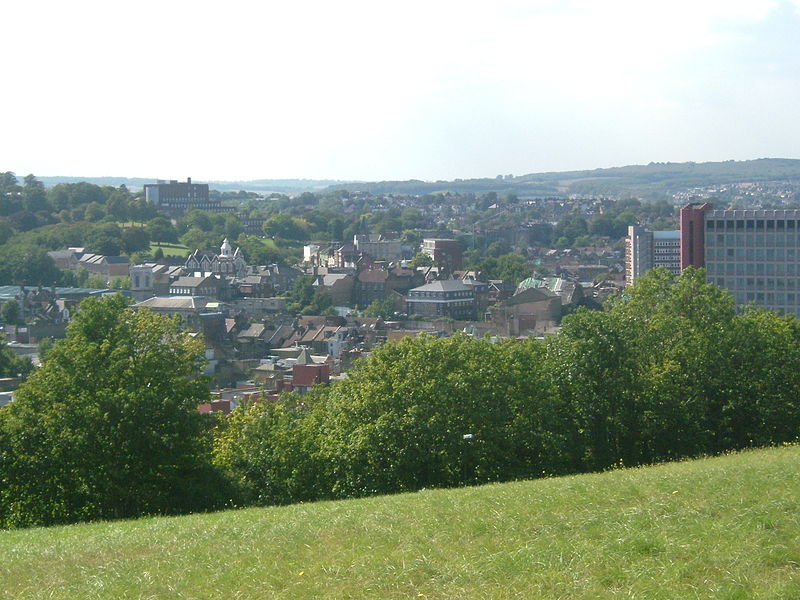
The Great Lines were part of the defence works around Chatham Dockyard to the north of Chatham, in Gillingham. Looking over Chatham. To the right is the Pentagon Office block, Mountbatten House. To the left is Victoria Gardens and FortPitt with the KIAD descending the hill. On the horizon we see Strood, Temple Wood, Ranscombe Farm, and Cuxton on the North Downs. Standard. The nick on the tree line is where the M2 runs.
|
||||
| Date | 13 September | ||||
| Source | Own work | ||||
| Author | Clem Rutter, Rochester Kent | ||||
| Permission (Reusing this file) |
Own work, attribution required (Multi-license with GFDL and Creative Commons CC-BY 2.5) |
I, the copyright holder of this work, hereby publish it under the following licenses:

|
Permission is granted to copy, distribute and/or modify this document under the terms of the GNU Free Documentation License, Version 1.2 or any later version published by the Free Software Foundation; with no Invariant Sections, no Front-Cover Texts, and no Back-Cover Texts. A copy of the license is included in the section entitled GNU Free Documentation License. |
| This file is licensed under the Creative Commons Attribution-Share Alike 3.0 Unported license. | ||
| ||
| This licensing tag was added to this file as part of the GFDL licensing update. |
This file is licensed under the Creative Commons Attribution 2.5 Generic license.
- You are free:
- to share – to copy, distribute and transmit the work
- to remix – to adapt the work
- Under the following conditions:
- attribution – You must give appropriate credit, provide a link to the license, and indicate if changes were made. You may do so in any reasonable manner, but not in any way that suggests the licensor endorses you or your use.
You may select the license of your choice.
File history
Click on a date/time to view the file as it appeared at that time.
| Date/Time | Thumbnail | Dimensions | User | Comment | |
|---|---|---|---|---|---|
| current | 20:23, 14 September 2007 | | 2,016 × 1,512 (935 KB) | ClemRutter | {{Information |Description=The Great Lines were part of the defence works around Chatham Dockyard to the north of Chatham. in Gillingham, Kent.. Looking over Chatham. To the right is the Pentagon Office block. To the left is Victoria Gardens a |
File usage
The following file is a duplicate of this file (more details):
- File:GillinghamGreatLines2718.JPG from a shared repository
The following page links to this file: