File:Former Broxburn Shale Oil Works - geograph.org.uk - 1018508.jpg
From Wikishire
No higher resolution available.
Former_Broxburn_Shale_Oil_Works_-_geograph.org.uk_-_1018508.jpg (640 × 480 pixels, file size: 86 KB, MIME type: image/jpeg)
Summary
| Description |
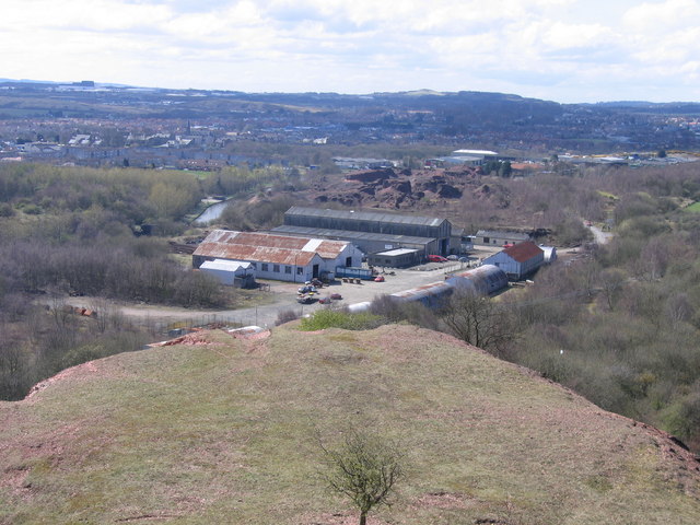
English: Former Broxburn Shale Oil Works Taken from the top of the tip comprising the waste rock from which the oil has been extracted, the surviving buildings of the former shale oil works, now known as Albyn Industrial Estate, are in the middle of the picture, with the villages of Broxburn and, to the right, Uphall beyond and some of the buildings of Livingston New Town visible on the far skyline. |
| Date | |
| Source | From geograph.org.uk |
| Author | A-M-Jervis |
| Attribution (required by the license) | A-M-Jervis / Former Broxburn Shale Oil Works / |
| Camera location | | View this and other nearby images on: OpenStreetMap |
|---|
_heading:225.00&language=en)
| Object location | | View this and other nearby images on: OpenStreetMap |
|---|
_heading:225.00&language=en)
Licensing

|
This image was taken from the Geograph project collection. See this photograph's page on the Geograph website for the photographer's contact details. The copyright on this image is owned by A-M-Jervis and is licensed for reuse under the Creative Commons Attribution-ShareAlike 2.0 license.
|
This file is licensed under the Creative Commons Attribution-Share Alike 2.0 Generic license.
Attribution: A-M-Jervis
- You are free:
- to share – to copy, distribute and transmit the work
- to remix – to adapt the work
- Under the following conditions:
- attribution – You must give appropriate credit, provide a link to the license, and indicate if changes were made. You may do so in any reasonable manner, but not in any way that suggests the licensor endorses you or your use.
- share alike – If you remix, transform, or build upon the material, you must distribute your contributions under the same or compatible license as the original.
File history
Click on a date/time to view the file as it appeared at that time.
| Date/Time | Thumbnail | Dimensions | User | Comment | |
|---|---|---|---|---|---|
| current | 10:48, 23 February 2011 | | 640 × 480 (86 KB) | GeographBot | == {{int:filedesc}} == {{Information |description={{en|1=Former Broxburn Shale Oil Works Taken from the top of the tip comprising the waste rock from which the oil has been extracted, the surviving buildings of the former shale oil works, now known as Alb |
File usage
The following file is a duplicate of this file (more details):
- File:Former Broxburn Shale Oil Works - geograph.org.uk - 1018508.jpg from a shared repository
The following page links to this file: