File:Farahouse.jpg
From Wikishire
No higher resolution available.
Farahouse.jpg (500 × 375 pixels, file size: 50 KB, MIME type: image/jpeg)
Summary
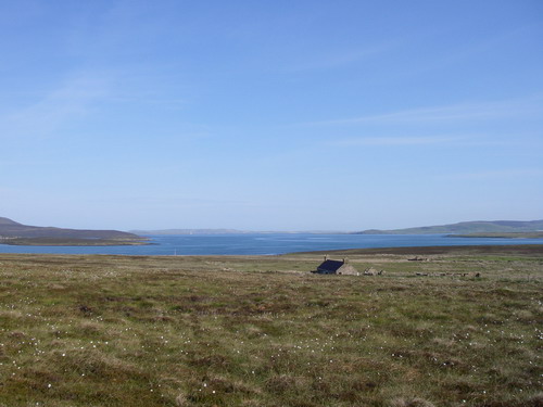
| Description | Abandoned House, Fara, Orkney Islands. Looking North: Rysa Little with Hoy behind to left; Graemsay with Mainland behind centre and right; Cava to right. | ||
| Date | See image source page. | ||
| Source |
This image was taken from the Geograph project collection. See this photograph's page on the Geograph website for the photographer's contact details. The copyright on this image is owned by Dave Simpson and is licensed for reuse under the Creative Commons Attribution-ShareAlike 2.0 license.
This file is licensed under the Creative Commons Attribution-Share Alike 2.0 Generic license. Attribution: Dave Simpson
|
||
| Author | See above. | ||
| Permission (Reusing this file) |
See above. |

| Camera location | | View this and other nearby images on: OpenStreetMap |
|---|
| Object location | | View this and other nearby images on: OpenStreetMap |
|---|
_region:GB-GBN_heading:337.00&language=en)
Licensing
This file is licensed under the Creative Commons Attribution-Share Alike 2.0 Generic license.
- You are free:
- to share – to copy, distribute and transmit the work
- to remix – to adapt the work
- Under the following conditions:
- attribution – You must give appropriate credit, provide a link to the license, and indicate if changes were made. You may do so in any reasonable manner, but not in any way that suggests the licensor endorses you or your use.
- share alike – If you remix, transform, or build upon the material, you must distribute your contributions under the same or compatible license as the original.
File history
Click on a date/time to view the file as it appeared at that time.
| Date/Time | Thumbnail | Dimensions | User | Comment | |
|---|---|---|---|---|---|
| current | 17:48, 15 October 2007 | | 500 × 375 (50 KB) | MacRusgail | == Summary == {{Information |Description=Abandoned House, Fara, Orkney Islands. Looking North: Rysa Little with Hoy behind to left; Graemsay with Mainland behind centre and right; Cava to right. |Source=This image was taken from the Geograph project c |
File usage
The following file is a duplicate of this file (more details):
- File:Farahouse.jpg from a shared repository
The following 2 pages link to this file: