File:Egmont-Soledad.PNG
From Wikishire
Size of this preview: 800 × 503 pixels. Other resolution: 320 × 201 pixels.
Original file (4,297 × 2,702 pixels, file size: 1.05 MB, MIME type: image/png)
Summary
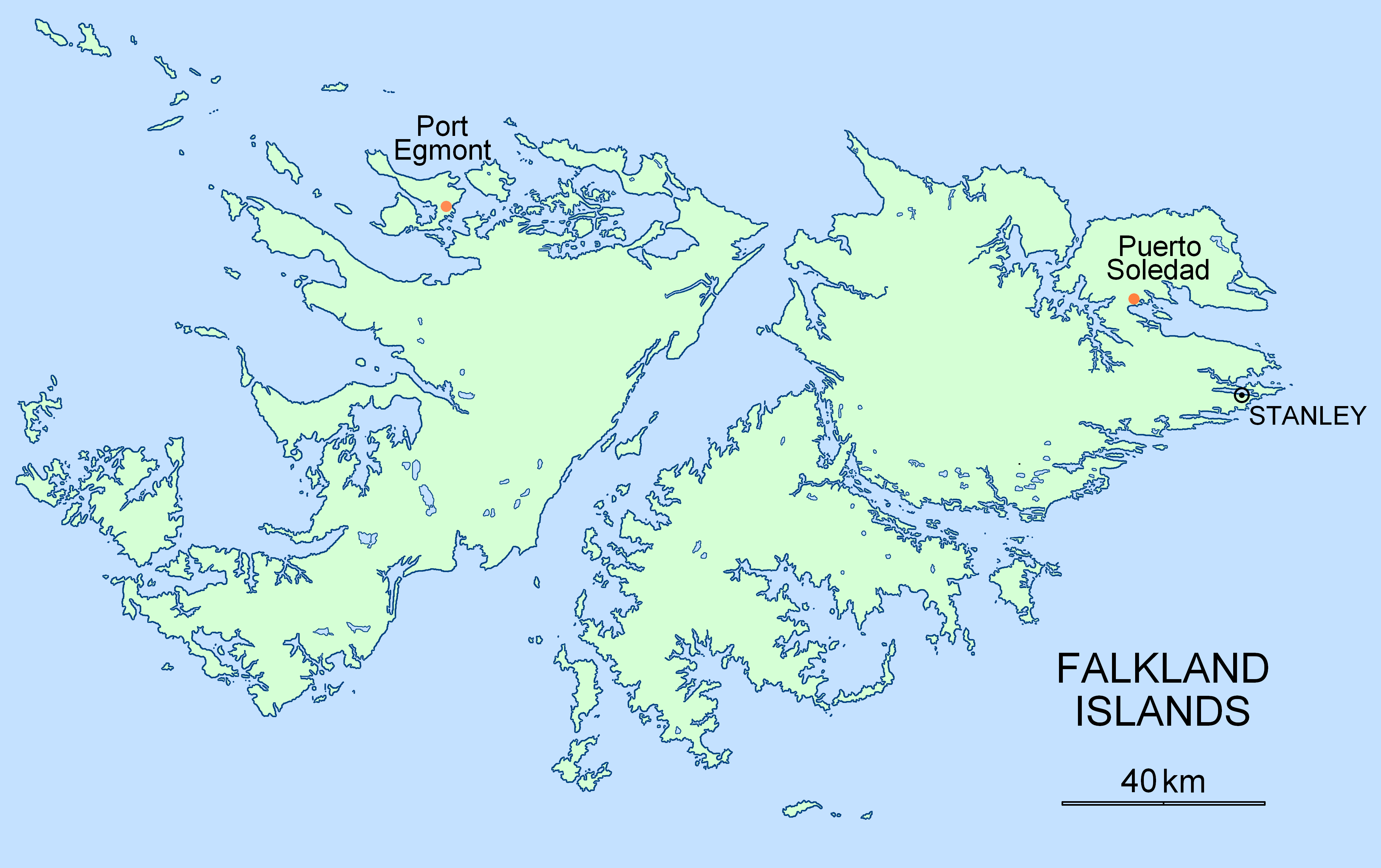
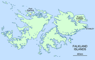
| Description | Location map for the historical settlements of Port Egmont and Puerto Soledad, Falkland Islands |
| Date | |
| Source | Own work |
| Author | Apcbg |
Licensing
| I, the copyright holder of this work, release this work into the public domain. This applies worldwide. In some countries this may not be legally possible; if so: I grant anyone the right to use this work for any purpose, without any conditions, unless such conditions are required by law. |
File history
Click on a date/time to view the file as it appeared at that time.
| Date/Time | Thumbnail | Dimensions | User | Comment | |
|---|---|---|---|---|---|
| current | 15:17, 7 November 2007 | | 4,297 × 2,702 (1.05 MB) | Apcbg | == Summary == {{Information |Description=Location map for the historical settlements of Port Egmont and Puerto Soledad, Falkland Islands |Source=self-made |Date=7 November 2007 |Author= Apcbg }} == Licensing == {{PD-self}} |
File usage
The following file is a duplicate of this file (more details):
- File:Egmont-Soledad.PNG from a shared repository
The following page links to this file: