File:Eglwys Sant Cynog Church of St Cynog Llangynog Powys 01.JPG
From Wikishire
Size of this preview: 800 × 533 pixels. Other resolution: 320 × 213 pixels.
Original file (3,916 × 2,609 pixels, file size: 1.25 MB, MIME type: image/jpeg)
Summary
| Description |
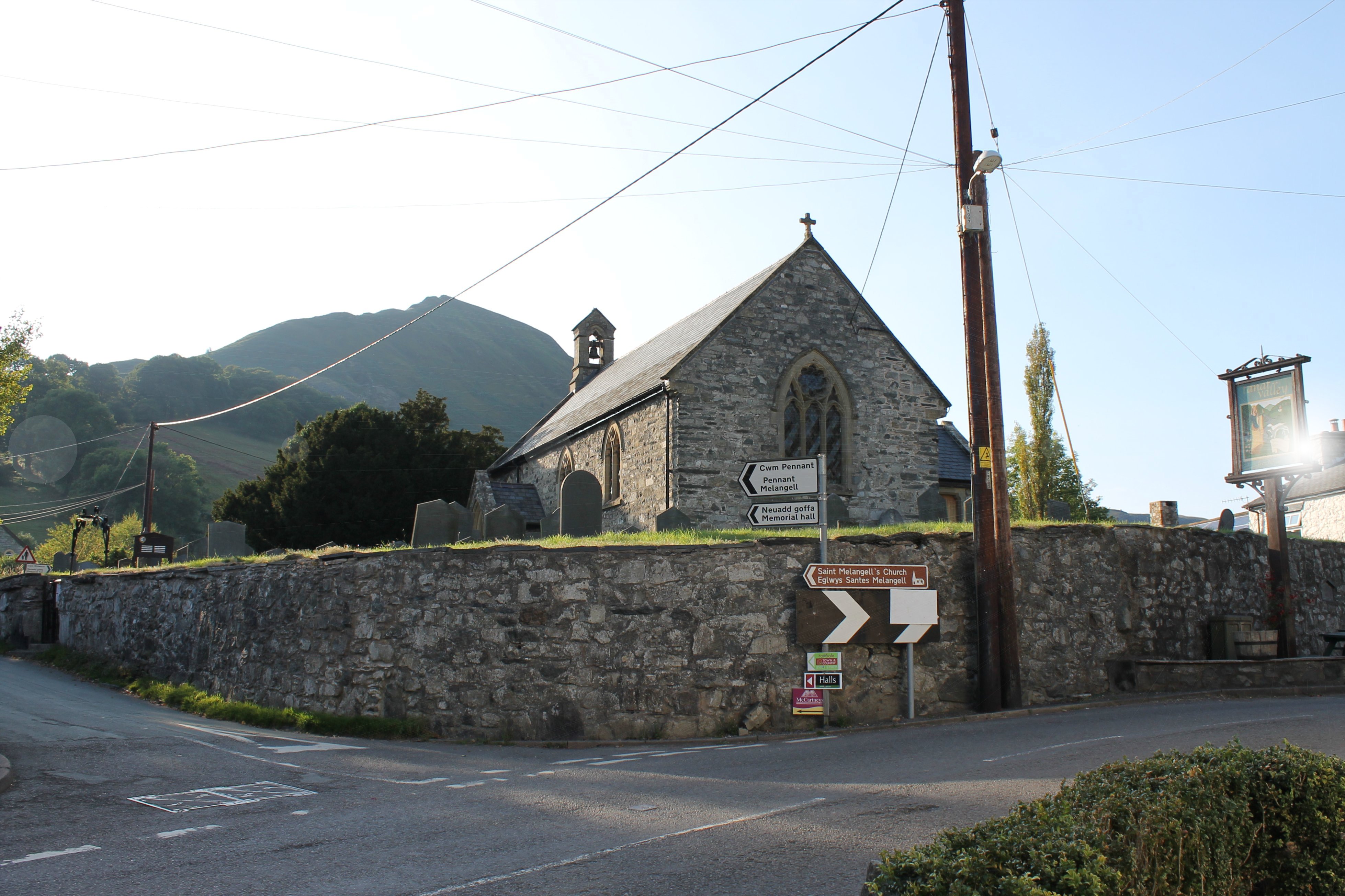
Cymraeg: Eglwys Sant Cynog, Llangynog, Powys, SY10 0ES. Ceir wal fawr gron o'i chwmpas sy'n awgrymu ei bod yn llawer hyn na'r dyddiad (1791) sydd arni. English: Church of St Cynog, Llangynog, Powys, SY10 0ES, is located at the centre of the village of Llangynog, in a raised churchyard enclosed by a tall wall. Dated 1791 in wall at north of churchyard.
|
||
| Date | |||
| Source | Own work | ||
| Author | Llywelyn2000 |
| Camera location | | View this and other nearby images on: OpenStreetMap |
|---|

|
This file was generated using equipment from Wikimedia UK, a Wikimedia local chapter.
|
OS Grid Coordinates: 305304, 326104
Licensing
I, the copyright holder of this work, hereby publish it under the following license:
This file is licensed under the Creative Commons Attribution-Share Alike 3.0 Unported license.
- You are free:
- to share – to copy, distribute and transmit the work
- to remix – to adapt the work
- Under the following conditions:
- attribution – You must give appropriate credit, provide a link to the license, and indicate if changes were made. You may do so in any reasonable manner, but not in any way that suggests the licensor endorses you or your use.
- share alike – If you remix, transform, or build upon the material, you must distribute your contributions under the same or compatible license as the original.

|
This image was uploaded as part of Wiki Loves Monuments 2014.
|
File history
Click on a date/time to view the file as it appeared at that time.
| Date/Time | Thumbnail | Dimensions | User | Comment | |
|---|---|---|---|---|---|
| current | 21:18, 24 September 2014 | | 3,916 × 2,609 (1.25 MB) | Llywelyn2000 | User created page with UploadWizard |
File usage
The following file is a duplicate of this file (more details):
- File:Eglwys Sant Cynog Church of St Cynog Llangynog Powys 01.JPG from a shared repository
The following page links to this file: