File:Dyrham Park, house and church, from lawn.jpg
From Wikishire

Size of this preview: 800 × 393 pixels. Other resolution: 320 × 157 pixels.
Original file (4,280 × 2,104 pixels, file size: 4.71 MB, MIME type: image/jpeg)
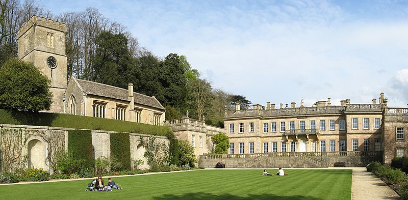
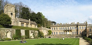
This is a photo of listed building number 1289711. |
Summary
| Description |
English: West side of Dyrham Park house and St Peter's Church, from west lawn. |
| Date | |
| Source | Own work |
| Author | Rwendland |
| Camera location | | View this and other nearby images on: OpenStreetMap |
|---|
Photo stitched together, using Hugin, from 3 photos taken at 2009-04-11 15:26 GMT with a Canon PowerShot A710 IS.
Licensing
I, the copyright holder of this work, hereby publish it under the following licenses:
This file is licensed under the Creative Commons Attribution-Share Alike 3.0 Unported license.
- You are free:
- to share – to copy, distribute and transmit the work
- to remix – to adapt the work
- Under the following conditions:
- attribution – You must give appropriate credit, provide a link to the license, and indicate if changes were made. You may do so in any reasonable manner, but not in any way that suggests the licensor endorses you or your use.
- share alike – If you remix, transform, or build upon the material, you must distribute your contributions under the same or compatible license as the original.

|
Permission is granted to copy, distribute and/or modify this document under the terms of the GNU Free Documentation License, Version 1.2 or any later version published by the Free Software Foundation; with no Invariant Sections, no Front-Cover Texts, and no Back-Cover Texts. A copy of the license is included in the section entitled GNU Free Documentation License. |
You may select the license of your choice.
File history
Click on a date/time to view the file as it appeared at that time.
| Date/Time | Thumbnail | Dimensions | User | Comment | |
|---|---|---|---|---|---|
| current | 00:54, 17 November 2010 | | 4,280 × 2,104 (4.71 MB) | Rwendland | {{Information |Description={{en|1=West side of Dyrham Park house and St Peter's Church, from west lawn.}} |Source={{own}} |Author=Rwendland |Date=2009-04-11 |Permission= |other_versions= }} |
File usage
The following file is a duplicate of this file (more details):
- File:Dyrham Park, house and church, from lawn.jpg from a shared repository
The following page links to this file: