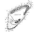
File:Ducie Map 1826 Beechey.JPG
Jump to navigation
Jump to search
Ducie_Map_1826_Beechey.JPG (508 × 497 pixels, file size: 35 KB, MIME type: image/jpeg)
File history
Click on a date/time to view the file as it appeared at that time.
| Date/Time | Thumbnail | Dimensions | User | Comment | |
|---|---|---|---|---|---|
| current | 21:23, 2 August 2011 |  | 508 × 497 (35 KB) | shared>GDuwen | {{Information |Description ={{en|1=Map of Ducie Island based on survey by Frederick William Beechey, part of Admiralty Chart 1176.}} |Source =http://si-pddr.si.edu/jspui/bitstream/10088/5024/1/00183.pdf |Author =Frederick William Beeche |
File usage
The following page uses this file: