File:Danger Island commemorative plaque.jpg
From Wikishire

Size of this preview: 397 × 599 pixels. Other resolution: 159 × 240 pixels.
Original file (1,229 × 1,854 pixels, file size: 257 KB, MIME type: image/jpeg)
Summary
| Description |
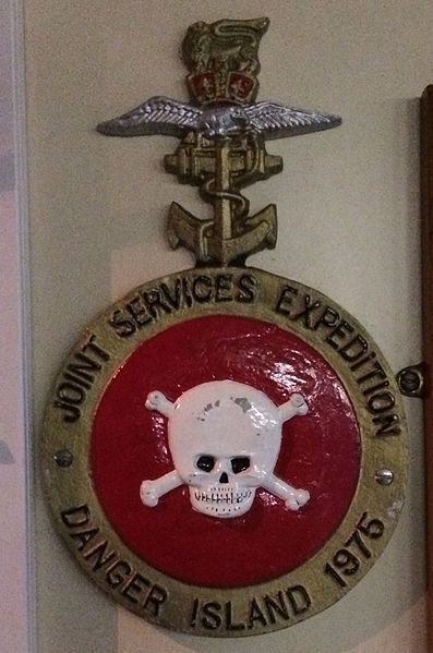
English: Plaque commemorating the Joint Services 1975 expedition to Danger Island. |
| Date | |
| Source | Own work |
| Author | Springnuts |
| Camera location | | View this and other nearby images on: OpenStreetMap |
|---|
Licensing
I, the copyright holder of this work, hereby publish it under the following license:
This file is licensed under the Creative Commons Attribution 4.0 International license.
- You are free:
- to share – to copy, distribute and transmit the work
- to remix – to adapt the work
- Under the following conditions:
- attribution – You must give appropriate credit, provide a link to the license, and indicate if changes were made. You may do so in any reasonable manner, but not in any way that suggests the licensor endorses you or your use.
File history
Click on a date/time to view the file as it appeared at that time.
| Date/Time | Thumbnail | Dimensions | User | Comment | |
|---|---|---|---|---|---|
| current | 08:41, 6 February 2015 | | 1,229 × 1,854 (257 KB) | Springnuts | User created page with UploadWizard |
File usage
The following file is a duplicate of this file (more details):
- File:Danger Island commemorative plaque.jpg from a shared repository
The following page links to this file: