File:Criffel Street, Silloth.jpg
From Wikishire
No higher resolution available.
Criffel_Street,_Silloth.jpg (640 × 475 pixels, file size: 96 KB, MIME type: image/jpeg)
| Description |
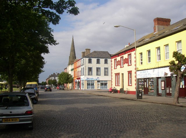
Original description: Criffel Street, Silloth Silloth was developed as a fashionable spa town, but was not very successful, but is now attractive with its bright colour-washed buildings. It was planned by Messrs Hay of Liverpool as a grid of wide tree-lined streets. The main street is Criffel Street, named after the prominent mountain over the Solway Firth. On the seaward side of Criffel Street there is a large green, with pine trees, between the town and the well built Promenade, which gives good views across the Solway. The granite setts are now 'heritage' and a tourist attraction. |
| Date | |
| Source | From geograph.org.uk |
| Author | Humphrey Bolton |
| Permission (Reusing this file) |
Creative Commons Attribution Share-alike license 2.0 |
| Camera location | | View this and other nearby images on: OpenStreetMap |
|---|

|
This image was taken from the Geograph project collection. See this photograph's page on the Geograph website for the photographer's contact details. The copyright on this image is owned by Humphrey Bolton and is licensed for reuse under the Creative Commons Attribution-ShareAlike 2.0 license.
|
This file is licensed under the Creative Commons Attribution-Share Alike 2.0 Generic license.
Attribution: Humphrey Bolton
- You are free:
- to share – to copy, distribute and transmit the work
- to remix – to adapt the work
- Under the following conditions:
- attribution – You must give appropriate credit, provide a link to the license, and indicate if changes were made. You may do so in any reasonable manner, but not in any way that suggests the licensor endorses you or your use.
- share alike – If you remix, transform, or build upon the material, you must distribute your contributions under the same or compatible license as the original.
File history
Click on a date/time to view the file as it appeared at that time.
| Date/Time | Thumbnail | Dimensions | User | Comment | |
|---|---|---|---|---|---|
| current | 22:28, 10 May 2008 | | 640 × 475 (96 KB) | Edward | {{Information |Description=w:Silloth Original description: '''Criffel Street, Silloth''' Silloth was developed as a fashionable spa town, but was not very successful, but is now attractive with its bright colour-washed buildings. It was planned b |
File usage
The following file is a duplicate of this file (more details):
- File:Criffel Street, Silloth.jpg from a shared repository
The following page links to this file: