File:CottagesTurweston(AndrewSmith)Mar2006.jpg
From Wikishire
No higher resolution available.
CottagesTurweston(AndrewSmith)Mar2006.jpg (640 × 427 pixels, file size: 112 KB, MIME type: image/jpeg)
Mar2006.jpg)
| Description |
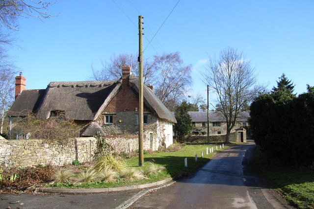
English: Turweston, Buckinghamshire. On the left is Thatched Rose Cottage, which is 17th- or 18th-century. Ahead is Turweston Barn, now converted into a private house. |
| Date | |
| Source | From geograph.org.uk |
| Author | Andrew Smith |
| Permission (Reusing this file) |
Creative Commons Attribution Share-alike license 2.0 |
| Camera location | | View this and other nearby images on: OpenStreetMap |
|---|
Mar2006.jpg¶ms=052.032680_N_-001.128260_E_globe:Earth_type:camera__&language=en)
This is a photo of listed building number 1289373. |

|
This image was taken from the Geograph project collection. See this photograph's page on the Geograph website for the photographer's contact details. The copyright on this image is owned by Andrew Smith and is licensed for reuse under the Creative Commons Attribution-ShareAlike 2.0 license.
|
This file is licensed under the Creative Commons Attribution-Share Alike 2.0 Generic license.
Attribution: Andrew Smith
- You are free:
- to share – to copy, distribute and transmit the work
- to remix – to adapt the work
- Under the following conditions:
- attribution – You must give appropriate credit, provide a link to the license, and indicate if changes were made. You may do so in any reasonable manner, but not in any way that suggests the licensor endorses you or your use.
- share alike – If you remix, transform, or build upon the material, you must distribute your contributions under the same or compatible license as the original.
Original upload log
The original description page was here. All following user names refer to en.wikipedia.
- 2006-08-31 21:53 Euchiasmus 640×427×??? (114558 bytes) Picture of cottages in Turweston, England, taken by Andrew Smith in 2006 and placed on the geograph website under a Creative Commons License. Image can be seen at https://www.geograph.org.uk/photo/143149 (accessed 2006-08-31)
File history
Click on a date/time to view the file as it appeared at that time.
| Date/Time | Thumbnail | Dimensions | User | Comment | |
|---|---|---|---|---|---|
| current | 10:33, 19 September 2008 | | 640 × 427 (112 KB) | Angusmclellan | {{Information |Description=Cottages, Turweston, Northamptonshire |Source=From [http://www.geograph.org.uk/photo/143149 geograph.org.uk] |Date=2006-03-25 |Author=[http://www.geograph.org.uk/profile/2562 Andrew Smith] |Permission=Creative Commons Attributio |
File usage
The following file is a duplicate of this file (more details):
Mar2006.jpg)
- File:CottagesTurweston(AndrewSmith)Mar2006.jpg from a shared repository
The following page links to this file:
Mar2006.jpg)
Mar2006.jpg)
Mar2006.jpg&action=edit&redlink=1)
Mar2006.jpg)
Mar2006.jpg&printable=yes)
Mar2006.jpg&action=info)