File:Cliffe Common former station geograph-3150075-by-Ben-Brooksbank.jpg
From Wikishire
Size of this preview: 800 × 482 pixels. Other resolution: 320 × 193 pixels.
Original file (2,230 × 1,344 pixels, file size: 2.59 MB, MIME type: image/jpeg)
Summary
| Description |
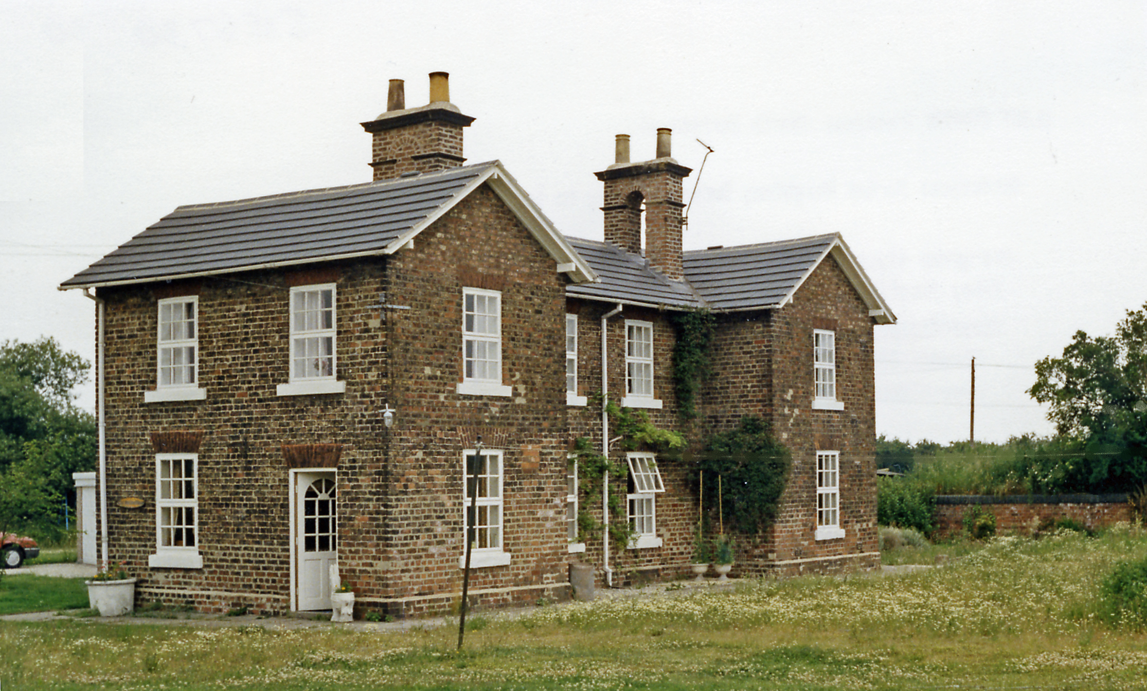
English: Former station at Cliffe Common, 1988. View eastward, towards Market Weighton etc. on ex-NER Selby - Market Weighton - Bridlington line, closed 14/6/65. This substantial station house had been on the Down side of this line, the station having been closed earlier (20/9/54). Cliff Common had also been the terminus of the Derwent Valley Light Railway from York (Layerthorpe), until 1/9/26 when passenger services ceased - after only 13 years, but the DVLR carried goods traffic to Cliff Common until 9/2/65, when it was cut back to York in stages, finally ending on 27/9/81. |
| Date | Taken on 24 June 1988 |
| Source | From geograph.org.uk |
| Author | Ben Brooksbank |
| Permission (Reusing this file) |
Creative Commons Attribution Share-alike license 2.0 |
| Attribution (required by the license) | Ben Brooksbank / Former station at Cliffe Common, 1988 / |
| Camera location | | View this and other nearby images on: OpenStreetMap |
|---|
Licensing

|
This image was taken from the Geograph project collection. See this photograph's page on the Geograph website for the photographer's contact details. The copyright on this image is owned by Ben Brooksbank and is licensed for reuse under the Creative Commons Attribution-ShareAlike 2.0 license.
|
This file is licensed under the Creative Commons Attribution-Share Alike 2.0 Generic license.
Attribution: Ben Brooksbank
- You are free:
- to share – to copy, distribute and transmit the work
- to remix – to adapt the work
- Under the following conditions:
- attribution – You must give appropriate credit, provide a link to the license, and indicate if changes were made. You may do so in any reasonable manner, but not in any way that suggests the licensor endorses you or your use.
- share alike – If you remix, transform, or build upon the material, you must distribute your contributions under the same or compatible license as the original.
File history
Click on a date/time to view the file as it appeared at that time.
| Date/Time | Thumbnail | Dimensions | User | Comment | |
|---|---|---|---|---|---|
| current | 08:54, 7 October 2012 | | 2,230 × 1,344 (2.59 MB) | Chevin | == {{int:filedesc}} == {{Information |Description={{en|1='''Former station at Cliffe Common, 1988.'''<br/> View eastward, towards Market Weighton etc. on ex-NER Selby - Market Weighton - Bridlington line, closed 14/6/65. This substantial station house ... |
File usage
The following file is a duplicate of this file (more details):
- File:Cliffe Common former station geograph-3150075-by-Ben-Brooksbank.jpg from a shared repository
The following page links to this file: